Esto, Florida
| Esto, Florida | |
|---|---|
| Town | |
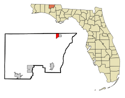 Location in Holmes County and the state of Florida | |
 Esto, Florida Location in the United States | |
| Coordinates: 30°58′52″N 85°38′49″W / 30.98111°N 85.64694°WCoordinates: 30°58′52″N 85°38′49″W / 30.98111°N 85.64694°W | |
| Country |
|
| State |
|
| County | Holmes |
| Area[1] | |
| • Total | 2.35 sq mi (6.10 km2) |
| • Land | 2.17 sq mi (5.62 km2) |
| • Water | 0.19 sq mi (0.48 km2) |
| Elevation | 233 ft (71 m) |
| Population (2010) | |
| • Total | 364 |
| • Estimate (2016)[2] | 357 |
| • Density | 164.59/sq mi (63.56/km2) |
| Time zone | UTC-6 (Central (CST)) |
| • Summer (DST) | UTC-5 (CDT) |
| FIPS code | 12-21250[3] |
| GNIS feature ID | 0282263[4] |
Esto is a town in Holmes County, Florida, United States. The population was 364 at the 2010 census.[5]
Geography
Esto is located in northeastern Holmes County at 30°58′52″N 85°38′49″W / 30.98111°N 85.64694°W (30.981052, -85.646857).[6] It is bordered to the north by the state of Alabama and to the east by the town of Noma, Florida. Florida State Road 79 is the main road through town, leading south 13 miles (21 km) to Bonifay, the Holmes County seat, and north (as Alabama State Route 167) 9 miles (14 km) to Hartford, Alabama. Florida State Road 2 follows the southern border of Esto, and leads east 8 miles (13 km) to Graceville and west 20 miles (32 km) to State Road 81. Dothan, Alabama, 25 miles (40 km) to the northeast, is the closest city with more than 50,000 people.
According to the United States Census Bureau, the town of Esto has a total area of 2.4 square miles (6.1 km2), of which 2.2 square miles (5.6 km2) are land and 0.2 square miles (0.5 km2), or 7.89%, are water.[5]
Demographics
| Historical population | |||
|---|---|---|---|
| Census | Pop. | %± | |
| 1910 | 340 | — | |
| 1920 | 269 | −20.9% | |
| 1930 | 190 | −29.4% | |
| 1940 | 213 | 12.1% | |
| 1950 | 217 | 1.9% | |
| 1960 | 148 | −31.8% | |
| 1970 | 210 | 41.9% | |
| 1980 | 304 | 44.8% | |
| 1990 | 253 | −16.8% | |
| 2000 | 356 | 40.7% | |
| 2010 | 364 | 2.2% | |
| Est. 2016 | 357 | [2] | −1.9% |
| U.S. Decennial Census[7] | |||
As of the census[3] of 2000, there were 356 people, 144 households, and 95 families residing in the town. The population density was 161.6 people per square mile (62.5/km²). There were 167 housing units at an average density of 75.8 per square mile (29.3/km²). The racial makeup of the town was 92.13% White, 2.25% African American, 3.93% Native American, 0.56% from other races, and 1.12% from two or more races. Hispanic or Latino of any race were 2.81% of the population.
There were 144 households out of which 30.6% had children under the age of 18 living with them, 50.7% were married couples living together, 9.0% had a female householder with no husband present, and 34.0% were non-families. 31.3% of all households were made up of individuals and 17.4% had someone living alone who was 65 years of age or older. The average household size was 2.47 and the average family size was 3.09.
In the town, the population was spread out with 28.1% under the age of 18, 7.6% from 18 to 24, 23.3% from 25 to 44, 26.4% from 45 to 64, and 14.6% who were 65 years of age or older. The median age was 37 years. For every 100 females, there were 110.7 males. For every 100 females age 18 and over, there were 100.0 males.
The median income for a household in the town was $31,667, and the median income for a family was $36,563. Males had a median income of $30,313 versus $15,625 for females. The per capita income for the town was $12,961. About 15.7% of families and 12.5% of the population were below the poverty line, including 16.8% of those under age 18 and none of those age 65 or over.
References
- ↑ "2016 U.S. Gazetteer Files". United States Census Bureau. Retrieved Jul 7, 2017.
- 1 2 "Population and Housing Unit Estimates". Retrieved June 9, 2017.
- 1 2 "American FactFinder". United States Census Bureau. Retrieved 2008-01-31.
- ↑ "US Board on Geographic Names". United States Geological Survey. 2007-10-25. Retrieved 2008-01-31.
- 1 2 "Geographic Identifiers: 2010 Demographic Profile Data (G001): Esto town, Florida". American Factfinder. U.S. Census Bureau. Retrieved May 8, 2017.
- ↑ "US Gazetteer files: 2010, 2000, and 1990". United States Census Bureau. 2011-02-12. Retrieved 2011-04-23.
- ↑ "Census of Population and Housing". Census.gov. Archived from the original on May 12, 2015. Retrieved June 4, 2015.
Municipalities and communities of Holmes County, Florida, United States | ||
|---|---|---|
| City | 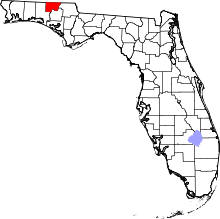 | |
| Towns | ||
| Unincorporated communities | ||