Erymanthos (river)
| Erymanthos (Ερύμανθος) | |
|---|---|
 | |
| Country | Greece |
| Physical characteristics | |
| Main source | Peloponnese |
| River mouth |
Alfeios 37°35′10″N 21°47′42″E / 37.58611°N 21.79500°ECoordinates: 37°35′10″N 21°47′42″E / 37.58611°N 21.79500°E |
| Length | about 50 km (31 mi) |
| Basin features | |
| Progression | Alfeios→ Ionian Sea |

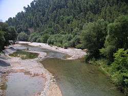
Erymanthos River and the old arched stone bridge in Tripotama village, Achaia-Ilia borders.
Erymanthos (Greek: Ερύμανθος, Latin: Erymanthus) is a river in the western part of the Peloponnese in Greece. Its source is on the southern slope of the Mount Erymanthos, near the village Agrampela, Achaea. It flows towards the south through a rocky landscape and receives several small tributaries. The river flows into an area rich in pine trees and passes several small mountain villages including Tripotama. Beyond Tripotama it forms the border between Elis and Arcadia. It flows east of the Foloi oak forest. The river empties into the Alfeios 5 km west of the Ladon (river) confluence, near the village Tripotamia.
Places along the river
This article is issued from
Wikipedia.
The text is licensed under Creative Commons - Attribution - Sharealike.
Additional terms may apply for the media files.