Karesuando
| Karesuando | |
|---|---|
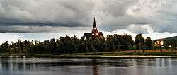 Karesuando Church in August 2005 | |
 Karesuando 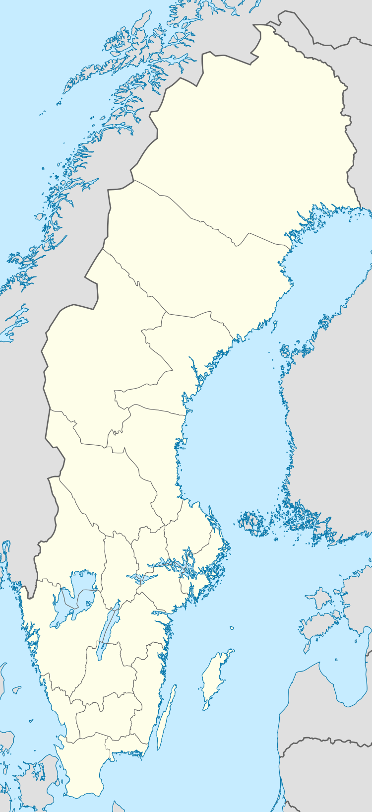 Karesuando | |
| Coordinates: 68°26′28″N 022°28′44″E / 68.44111°N 22.47889°ECoordinates: 68°26′28″N 022°28′44″E / 68.44111°N 22.47889°E | |
| Country | Sweden |
| Province | Lapland |
| County | Norrbotten County |
| Municipality | Kiruna Municipality |
| Area[1] | |
| • Total | 0.93 km2 (0.36 sq mi) |
| Population (31 December 2010)[2] | |
| • Total | 300 |
| • Density | 324/km2 (840/sq mi) |
| Time zone | UTC+1 (CET) |
| • Summer (DST) | UTC+2 (CEST) |
Karesuando (Finnish: Kaaresuvanto or Karesuvanto, Sami: Karesuanto, Gárasavvon or Karasavvon) is the northernmost locality in Sweden. It is situated in Kiruna Municipality, Norrbotten County, Sweden, with 303 inhabitants in 2010[1] and 350 in 2011.[2]
It is a church village, located alongside the Muonio River on the border with Finland.
The Finnish village of Karesuvanto (population about 140) is located on the Finnish side of the river. According to Finnish tradition, they are one and the same village (with a combined population of about 470), but are usually considered to be separate villages since there is a national border between them (although both are called Karesuvanto in Finnish).
The village's buildings were built in 1670, when Måns Mårtensson Karesuando, called "Hyvä Maunu Martinpoika" in Finnish and "Good Maunu, Son of Martin" in English, bought land from Sami Henrik Nilsson Nikkas. The Lutheran vicar and botanist Lars Levi Laestadius served in Karesuando from 1826 to 1849. It was here that he founded the revivalist movement known to this day as Laestadianism.
The area is traditionally Finnish speaking, and the border was drawn for political reasons in 1809, not because of any cultural or any other border existing at that time. School and church influences have since resulted in cultural and linguistic differences.
Karesuando is located along the European route E45, and is the northern terminus of Swedish national road 99.
Climate
| Climate data for Karesuando, 1961-1990 | |||||||||||||
|---|---|---|---|---|---|---|---|---|---|---|---|---|---|
| Month | Jan | Feb | Mar | Apr | May | Jun | Jul | Aug | Sep | Oct | Nov | Dec | Year |
| Record high °C (°F) | 7.2 (45) |
6.2 (43.2) |
10.5 (50.9) |
15.5 (59.9) |
27.2 (81) |
32.2 (90) |
32.5 (90.5) |
29.1 (84.4) |
24.0 (75.2) |
16.0 (60.8) |
9.0 (48.2) |
6.5 (43.7) |
32.5 (90.5) |
| Average high °C (°F) | −11.2 (11.8) |
−9.7 (14.5) |
−4.8 (23.4) |
0.8 (33.4) |
7.4 (45.3) |
14.7 (58.5) |
17.3 (63.1) |
14.6 (58.3) |
8.8 (47.8) |
1.5 (34.7) |
−5.3 (22.5) |
−9.0 (15.8) |
2.1 (35.8) |
| Daily mean °C (°F) | −16.0 (3.2) |
−14.6 (5.7) |
−10.0 (14) |
−3.7 (25.3) |
3.4 (38.1) |
10.3 (50.5) |
12.8 (55) |
10.4 (50.7) |
5.0 (41) |
−1.6 (29.1) |
−9.1 (15.6) |
−14.0 (6.8) |
−2.3 (27.9) |
| Average low °C (°F) | −21.2 (−6.2) |
−19.8 (−3.6) |
−15.6 (3.9) |
−8.7 (16.3) |
−0.7 (30.7) |
6.2 (43.2) |
8.4 (47.1) |
6.3 (43.3) |
1.4 (34.5) |
−4.8 (23.4) |
−13.3 (8.1) |
−18.9 (−2) |
−6.7 (19.9) |
| Record low °C (°F) | −49.0 (−56.2) |
−48.1 (−54.6) |
−42.8 (−45) |
−36.5 (−33.7) |
−22.0 (−7.6) |
−4.0 (24.8) |
−1.0 (30.2) |
−4.6 (23.7) |
−12.0 (10.4) |
−28.6 (−19.5) |
−38.0 (−36.4) |
−42.0 (−43.6) |
−49.0 (−56.2) |
| Average precipitation mm (inches) | 23 (0.91) |
19 (0.75) |
23 (0.91) |
23 (0.91) |
28 (1.1) |
42 (1.65) |
75 (2.95) |
63 (2.48) |
45 (1.77) |
44 (1.73) |
34 (1.34) |
24 (0.94) |
443 (17.44) |
| Mean monthly sunshine hours | 5 | 62 | 139 | 183 | 232 | 266 | 243 | 159 | 110 | 67 | 18 | 0 | 1,484 |
| Source: [3] | |||||||||||||
References
- 1 2 "Tätorternas landareal, folkmängd och invånare per km2 2005 och 2010" (in Swedish). Statistics Sweden. 14 December 2011. Archived from the original on 10 January 2012. Retrieved 10 January 2012.
- 1 2 "Befolkningstabell" (in Swedish). Karesuando. 31 December 2011. Retrieved 1 April 2013.
- ↑ "NOAA.gov".
External links
