Emsetal
| Emsetal | |
|---|---|
| part of Waltershausen | |
 Emsetal | |
 Emsetal | |
| Coordinates: 50°53′1″N 10°27′22″E / 50.88361°N 10.45611°ECoordinates: 50°53′1″N 10°27′22″E / 50.88361°N 10.45611°E | |
| Country | Germany |
| State | Thuringia |
| District | Gotha |
| Town | Waltershausen |
| Area | |
| • Total | 29.87 km2 (11.53 sq mi) |
| Elevation | 375 m (1,230 ft) |
| Population (2012-12-31) | |
| • Total | 2,821 |
| • Density | 94/km2 (240/sq mi) |
| Time zone | CET/CEST (UTC+1/+2) |
| Postal codes | 99891 |
| Dialling codes | 036259 |
| Vehicle registration | GTH |
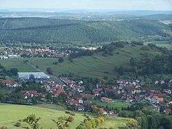
Emsetal is a former municipality in the district of Gotha, in Thuringia, Germany. It took its name from the river Emse. It consisted of the villages Fischbach, Schmerbach, Schwarzhausen and Winterstein. Since 31 December 2013, it is part of the town Waltershausen.
The Kilianstein is an unusual rock pinnacle in the municipality that is sometimes used by climbers. It is 800 m east of the village of Winterstein.
References
| Authority control |
|---|
This article is issued from
Wikipedia.
The text is licensed under Creative Commons - Attribution - Sharealike.
Additional terms may apply for the media files.