Emiotungan
| Emiotungan Meltungon | |
|---|---|
| Village | |
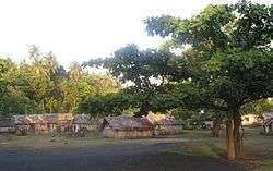 Emiotungan village, with tamtam. | |
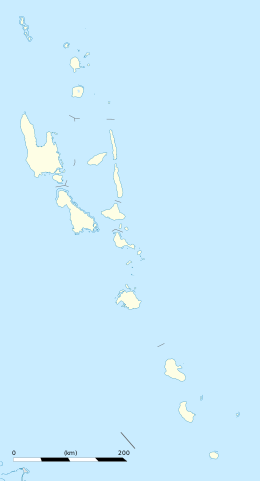 Emiotungan Location in Vanuatu | |
| Coordinates: 16°14′56″S 167°57′5″E / 16.24889°S 167.95139°ECoordinates: 16°14′56″S 167°57′5″E / 16.24889°S 167.95139°E | |
| Country |
|
| Province | Malampa Province |
| Island | Ambrym |
| Population (2009) | |
| • Total | 70 |
| Time zone | UTC+11 (VUT) |
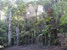
Nasara, cult place of Emiotungan.
Emiotungan, also Meltungon, is an inland village of about 70 inhabitants in the southwestern part of the island of Ambrym in Vanuatu.
Emiotungan, which means house of fight in the local Dakaka language, has a recognized nasara, a cult place used for ceremonies. It also has a Presbyterian church, an anglophone primary school shared with the coastal village of Baiap, and two guest houses for visitors.
Transportation
Connected to the airfield of Craig Cove by dirt road, it has an access road to the caldera with the two active volcanoes, Mt. Benbow and Mt. Marum.
This article is issued from
Wikipedia.
The text is licensed under Creative Commons - Attribution - Sharealike.
Additional terms may apply for the media files.