Glenorchy, Tasmania
| Glenorchy Hobart, Tasmania | |||||||||||||||
|---|---|---|---|---|---|---|---|---|---|---|---|---|---|---|---|
 Glenorchy | |||||||||||||||
| Coordinates | 42°49′59″S 147°16′33″E / 42.83306°S 147.27583°ECoordinates: 42°49′59″S 147°16′33″E / 42.83306°S 147.27583°E | ||||||||||||||
| Population | 10,828 (2016 census)[1] | ||||||||||||||
| • Density | 1,003.2/km2 (2,598/sq mi) | ||||||||||||||
| Postcode(s) | 7010 | ||||||||||||||
| Area | 10.5 km2 (4.1 sq mi) | ||||||||||||||
| LGA(s) | City of Glenorchy | ||||||||||||||
| State electorate(s) | Denison | ||||||||||||||
| Federal Division(s) | Denison | ||||||||||||||
| |||||||||||||||
Glenorchy City (named after Glen Orchy in Scotland) is bound by the Derwent River on the Eastern side, Mount Wellington on the Western side, Hobart City to the South and Brighton to the North. The Glenorchy CBD is the focal point for retail, doctors and government services. The land was originally used for agriculture (for the people of Old Hobart Town) (particularly orchards) but is now a largely suburban, working class area, that grew quickly after WWII as returning soldiers settle in State Government Housing suburbs. The city officially begins at Creek Road Newtown, in Hobart's northern suburbs, and includes, Moonah, Derwent Park, Lutana, Goodwood, Chigwell, Claremont and Austins ferry. It is the seat of the local government area of the same name, the City of Glenorchy.
Glenorchy has public facilities such as; the council swimming pool, a cinema, an Australian rules football oval (home to the Glenorchy Magpies FBC) and a football (soccer) ground (both part of the KGV Oval complex), a bowls club. Glenorchy is also home to the Tasmanian Transport Museum.
Schools in the area include Glenorchy Primary School, Cosgrove High School, Guilford Young College and Dominic College.
The main traffic route in and out of Glenorchy is the Main Road, which passes the area in a north-south direction. To the south this road becomes Elizabeth Street, Hobart, and to the north it becomes the Midland Highway. Glenorchy is bypassed by the Brooker Highway which runs along the shores of the Derwent river.
Glenorchy has localities such as:
- Elwick is the name given to the area east of the Brooker Highway, including the Elwick Racecourse (where the Hobart Cup is raced) and the Hobart Showground, which represents all of Southern Tasmania.
- Merton refers to the Barossa Road area, and the surrounding bushlands between Glenorchy and Lenah Valley.
- O'Brien's Bridge was the name of the first settlement in 1809.
At the 2016 Australian census, the suburb of Glenorchy had a population of 10,828.[1]
Retail
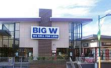
The Glenorchy Central business district also has three major indoor shopping centres, Northgate Shopping Centre, Glenorchy Central (Centro), and Glenorchy Plaza. The Main retail stores in Glenorchy are Best & Less, Coles, Woolworths, Big W, Mitre 10 Home & Trade and Target. A large Bunnings is located within the old show grounds on the Brooker Highway near Goodwood.
References
- 1 2 Australian Bureau of Statistics (27 June 2017). "Glenorchy (Tas.) (State Suburb)". 2016 Census QuickStats. Retrieved 29 March 2018.

External links