Aguajito
| El Aguajito | |
|---|---|
 | |
| Highest point | |
| Elevation | 1,300 m (4,300 ft) [1] |
| Coordinates | 27°36′N 112°32′W / 27.600°N 112.533°WCoordinates: 27°36′N 112°32′W / 27.600°N 112.533°W [1] |
| Geography | |
 El Aguajito | |
| Geology | |
| Mountain type | Caldera |
| Last eruption | Pleistocene |
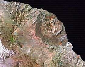
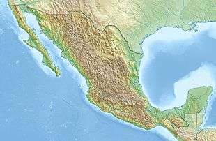
El Aguajito (also called Santa Ana caldera) is a caldera volcano located on the Gulf of California in Mexico.
It is located between the Tres Virgenes volcano and the La Reforma caldera.
References
- 1 2 "El Aguajito". Global Volcanism Program. Smithsonian Institution. Retrieved 2007-03-31.
This article is issued from
Wikipedia.
The text is licensed under Creative Commons - Attribution - Sharealike.
Additional terms may apply for the media files.