East Weymouth station
EAST WEYMOUTH | |||||||||||||
|---|---|---|---|---|---|---|---|---|---|---|---|---|---|
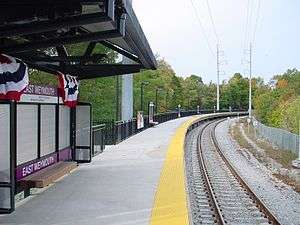 East Weymouth station in November 2007 | |||||||||||||
| Location |
1590 Commercial Street Weymouth, Massachusetts | ||||||||||||
| Coordinates | 42°13′8.76″N 70°55′17.04″W / 42.2191000°N 70.9214000°WCoordinates: 42°13′8.76″N 70°55′17.04″W / 42.2191000°N 70.9214000°W | ||||||||||||
| Owned by | Massachusetts Bay Transportation Authority | ||||||||||||
| Line(s) | |||||||||||||
| Platforms | 1 side platform | ||||||||||||
| Tracks | 1 | ||||||||||||
| Construction | |||||||||||||
| Parking |
335 spaces ($4.00 fee) 8 accessible spaces | ||||||||||||
| Disabled access | Yes | ||||||||||||
| Other information | |||||||||||||
| Fare zone | 2 | ||||||||||||
| History | |||||||||||||
| Opened | October 31, 2007[1] | ||||||||||||
| Closed | June 30, 1959 | ||||||||||||
| Traffic | |||||||||||||
| Passengers (2013) | 405 (weekday inbound average)[2] | ||||||||||||
| Services | |||||||||||||
| |||||||||||||
| |||||||||||||
East Weymouth is an MBTA Commuter Rail station in Weymouth, Massachusetts. It serves the Greenbush Line, and is located in the East Weymouth village. It consists of a single side platform serving the line's one track. The station is fully handicapped accessible.
History

East Weymouth station in the early 20th century
The New Haven Railroad abandoned its remaining Old Colony Division lines on June 30, 1959, after the completion of the Southeast Expressway.[1] The East Weymouth station had been located off Station Street.[3]
The MBTA reopened the Greenbush Line on October 31, 2007, with East Weymouth station off Commercial Street, east of the former location.[1]
Bus connections
One MBTA Bus route stops on Broad Street, several blocks to the south:
- 222 Quincy Center Station - East Weymouth via Bicknell Square
References
- 1 2 3 Belcher, Jonathan (December 30, 2016). "Changes to Transit Service in the MBTA district 1964-2016" (PDF). NETransit.
- ↑ "Ridership and Service Statistics" (PDF) (14th ed.). Massachusetts Bay Transportation Authority. 2014.
- ↑ "East Weymouth". Atlas of Norfolk County. E. Robinson. 1888 – via Ward Maps.
External links
![]()
This article is issued from
Wikipedia.
The text is licensed under Creative Commons - Attribution - Sharealike.
Additional terms may apply for the media files.