Dunkerque – Les Moëres Airport
| Dunkerque – Les Moëres Airfield | |||||||||||
|---|---|---|---|---|---|---|---|---|---|---|---|
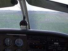 Cockpit view of runway at Dunkerque | |||||||||||
| Summary | |||||||||||
| Airport type | Restricted use | ||||||||||
| Operator | Syndicat Intercommunal des Dunes de Flandre | ||||||||||
| Location | Dunkerque | ||||||||||
| Elevation AMSL | -3 ft / -1 m | ||||||||||
| Coordinates | 51°2′32″N 2°33′11″E / 51.04222°N 2.55306°E | ||||||||||
| Website | www.aeroclub-dunkerque.com | ||||||||||
| Runways | |||||||||||
| |||||||||||
Dunkerque – Les Moëres Airport (ICAO: LFAK) is an aerodrome in Les Moëres, 12 kilometres (7.5 mi) east of Dunkerque, Nord, France.
Characteristics
- Terrain elevation : -1 meter
- Runway : 07/25 grass, 638x50m
- Two hangars for club planes
- Ultralight aviation activity on adjacent terrain
Aeroclubs on the airfield
- Dunkerque aeroclub
- Ultralight aviation club Les Cigognes, on a zone (200x35m) next to the main airfield
Events
- Annual meeting at the end of August.
General view of 2005 meeting
Planes
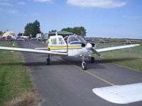
- 2 Robin DR400 (F-GDEM and F-GMOA)
- 2 Piper PA28 (F-GFJJ and F-GUAR)
External links
References and notes
This article is issued from
Wikipedia.
The text is licensed under Creative Commons - Attribution - Sharealike.
Additional terms may apply for the media files.