Dili Municipality
| Díli Dili | ||
|---|---|---|
| Municipality | ||
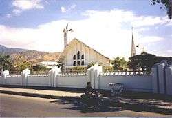 Cathedral of Dili | ||
| ||
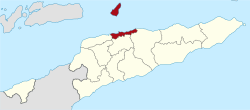 Map of East Timor highlighting Díli Municipality | ||
| Coordinates: 8°34′S 125°35′E / 8.567°S 125.583°ECoordinates: 8°34′S 125°35′E / 8.567°S 125.583°E | ||
| Country |
| |
| Capital | Dili | |
| Administrative posts |
| |
| Area | ||
| • Total | 367 km2 (142 sq mi) | |
| Area rank | 13th | |
| Population (2015 census) | ||
| • Total | 277,279 | |
| • Rank | 1st | |
| • Density | 760/km2 (2,000/sq mi) | |
| • Density rank | 1st | |
| Households (2015 census) | ||
| • Total | 42,485 | |
| • Rank | 1st | |
| Time zone | UTC+09:00 (TLT) | |
| ISO 3166 code | TL-DI | |

Dili is (Portuguese: Município Díli, Tetum: Munisípiu Dili) one of the 13 municipalities, formerly districts, of Timor-Leste, which includes the national capital Dili. It has a population of 277,279 (2015)[1], most of whom live in the capital city. The municipality has an area of 368.12 km². The municipality continued the same name as the council had in Portuguese Timor.
Geography
Dili is the smallest municipality in East Timor, but it has the highest population. It lies on the north coast of the island of Timor on the Savu Sea. It borders the municipalities of Manatuto to the east, Aileu to the south, and Liquiçá to the west. Atauro Island, to the north of the municipality opposite the capital, is one of its administrative posts.
Dili is the economic and political centre of East Timor.
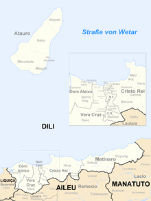
Administrative posts
The municipality's administrative posts (formerly sub-districts) are:[2]
- Atauro
- Cristo Rei
- Dom Aleixo
- Metinaro
- Nain Feto; and
- Vera Cruz
 Subdivisions of the municipality
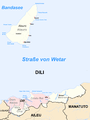 Cities in the municipality of Dili
References
- ↑ "2015 Timor-Leste Census". Statistics Timor-Leste.
- ↑ Gunn, Geoffrey C (2011). "Dili District". Historical Dictionary of East Timor. Lanham, Maryland: Scarecrow Press. p. 73. ISBN 9780810867543.
External links
![]()