Dahyat
| Dahyat | |
|---|---|
| village | |
| Country |
|
| State | Maharashtra |
| District | Satara district |
| Talukas | Wai |
| Languages | |
| • Official | Marathi |
| Time zone | UTC+5:30 (IST) |
Dahyat is a village in Satara district in the Indian state of Maharashtra.It is situated on the banks of the River Krishna.It is about 21 km from Wai, Maharashtra.
Demographics
As of 2011 India census, Dahyat had a population of 541 in 120 households. Male and female both constitutes 50% of the population. Dahyat has an average literacy rate of 69%, lower than the national average of 74%: male literacy is 57.7%, and female literacy is 42.2%. In Dahyat, 9.6% of the population is under 6 years of age.
Temples
- There are 3 major temples in Dahyat:
- 1)Ram Mandir
- 2)Janni Deul
- 3)Bhairoba Mandir
- 4)Mariaai Deul
Special Highlights
- 1)River Krishna
- 2)Kamalgad
- 3)Gothmi hill
- 4)Vetal hill
References
Some clicks
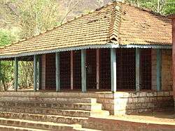
Bhairoba temple in Dahyat
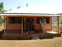
Ram Mandir in Dahyat
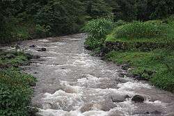
Krishna River in Dahyat
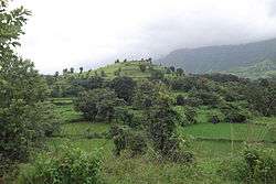
Gothmi hill in Dahyat in rainy season
This article is issued from
Wikipedia.
The text is licensed under Creative Commons - Attribution - Sharealike.
Additional terms may apply for the media files.