Czarny Dunajec
| Czarny Dunajec | ||
|---|---|---|
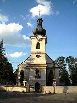 Holy Trinity Church | ||
| ||
 Czarny Dunajec | ||
| Coordinates: 49°26′22″N 19°51′15″E / 49.43944°N 19.85417°ECoordinates: 49°26′22″N 19°51′15″E / 49.43944°N 19.85417°E | ||
| Country |
| |
| Voivodeship | Lesser Poland | |
| County | Nowy Targ County | |
| Gmina | Gmina Czarny Dunajec | |
| Area | ||
| • Total | 21.72 km2 (8.39 sq mi) | |
| Population | ||
| • Total | 3,501 | |
| • Density | 160/km2 (420/sq mi) | |
| Time zone | UTC+1 (CET) | |
| • Summer (DST) | UTC+2 (CEST) | |
| Postal code | 34-470 | |
| Area code(s) | +48 18 | |
| Car plates | KNT | |
Czarny Dunajec [ˈt͡ʂarnɨ duˈnajɛt͡s], (Slovak: Čierny Dunajec) is a village located in southern Poland near the Polish-Slovak border. Czarny Dunajec is in the Nowy Targ County (Polish: Powiat Nowotarski) and in the Lesser Poland. Czarny Dunajec is about 60 miles south of Kraków.
External links
- Municipal Office
- Elementary and Middle School (sometimes offline)
- Jewish Community in Czarny Dunajec on Virtual Shtetl
- Czarny Dunajec (outdated)
See also
| Wikimedia Commons has media related to Czarny Dunajec. |
| Seat | ||
|---|---|---|
| Other villages | ||
This article is issued from
Wikipedia.
The text is licensed under Creative Commons - Attribution - Sharealike.
Additional terms may apply for the media files.