Cuba, New Mexico
| Cuba, New Mexico | |
|---|---|
| Village | |
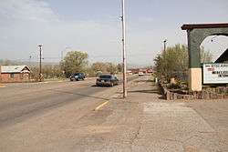 U.S. Route 550 in Cuba | |
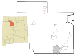 Location of Cuba, New Mexico | |
 Cuba, New Mexico Location in the United States | |
| Coordinates: 36°1′6″N 106°57′35″W / 36.01833°N 106.95972°WCoordinates: 36°1′6″N 106°57′35″W / 36.01833°N 106.95972°W | |
| Country | United States |
| State | New Mexico |
| County | Sandoval |
| Area | |
| • Total | 1.3 sq mi (3.3 km2) |
| • Land | 1.3 sq mi (3.3 km2) |
| • Water | 0.0 sq mi (0.0 km2) |
| Elevation | 6,906 ft (2,105 m) |
| Population (2010) | |
| • Total | 731 |
| • Estimate (2016)[1] | 740 |
| • Density | 560/sq mi (220/km2) |
| Time zone | UTC-7 (Mountain (MST)) |
| • Summer (DST) | UTC-6 (MDT) |
| ZIP code | 87013 |
| Area code(s) | 575 |
| FIPS code | 35-19150 |
| GNIS feature ID | 0915817 |
Cuba is a village in Sandoval County, New Mexico, in the United States. As of the 2010 census, the village population was 735. It is part of the Albuquerque Metropolitan Statistical Area. Located off the busy 550 highway, Cuba has several motels, restaurants and bars.
Geography
Cuba is located at 36°1′6″N 106°57′35″W / 36.01833°N 106.95972°W (36.018325, -106.959642).[2]
According to the United States Census Bureau, the village has a total area of 1.3 square miles (3.4 km2), all of it land.
Demographics
| Historical population | |||
|---|---|---|---|
| Census | Pop. | %± | |
| 1970 | 415 | — | |
| 1980 | 609 | 46.7% | |
| 1990 | 760 | 24.8% | |
| 2000 | 590 | −22.4% | |
| 2010 | 731 | 23.9% | |
| Est. 2016 | 740 | [1] | 1.2% |
| U.S. Decennial Census[3] | |||
As of the census[4] of 2000, there were 590 people, 222 households, and 152 families residing in the village. The population density was 465.3 people per square mile (179.4/km²). There were 290 housing units at an average density of 228.7 per square mile (88.2/km²). The racial makeup of the village was 44.07% White, 0.17% African American, 26.78% Native American, 0.68% Asian, 23.90% from other races, and 4.41% from two or more races. Hispanic or Latino of any race were 60.34% of the population.
There were 222 households out of which 38.3% had children under the age of 18 living with them, 43.7% were married couples living together, 18.9% had a female householder with no husband present, and 31.1% were non-families. 29.3% of all households were made up of individuals and 8.1% had someone living alone who was 65 years of age or older. The average household size was 2.66 and the average family size was 3.24.
In the village, the population was spread out with 33.2% under the age of 18, 7.8% from 18 to 24, 23.9% from 25 to 44, 21.9% from 45 to 64, and 13.2% who were 65 years of age or older. The median age was 32 years. For every 100 females, there were 99.3 males. For every 100 females age 18 and over, there were 95.0 males.
The median income for a household in the village was $21,538, and the median income for a family was $26,250. Males had a median income of $26,667 versus $17,000 for females. The per capita income for the village was $11,192. About 36.5% of families and 41.3% of the population were below the poverty line, including 54.1% of those under age 18 and 40.0% of those age 65 or over.
National Christmas Tree
The National Christmas Tree for 2005 was harvested from the Santa Fe National Forest near Cuba.
Climate
| Climate data for Cuba, NM, 1981-2010 normals, extremes 1938-present | |||||||||||||
|---|---|---|---|---|---|---|---|---|---|---|---|---|---|
| Month | Jan | Feb | Mar | Apr | May | Jun | Jul | Aug | Sep | Oct | Nov | Dec | Year |
| Record high °F (°C) | 65 (18) |
68 (20) |
79 (26) |
82 (28) |
96 (36) |
99 (37) |
102 (39) |
96 (36) |
97 (36) |
88 (31) |
75 (24) |
74 (23) |
102 (39) |
| Average high °F (°C) | 43.7 (6.5) |
46.7 (8.2) |
55.0 (12.8) |
63.8 (17.7) |
72.7 (22.6) |
82.6 (28.1) |
85.8 (29.9) |
82.9 (28.3) |
77.1 (25.1) |
65.5 (18.6) |
53.0 (11.7) |
43.4 (6.3) |
64.4 (18) |
| Average low °F (°C) | 9.3 (−12.6) |
13.7 (−10.2) |
20.6 (−6.3) |
25.4 (−3.7) |
33.2 (0.7) |
39.9 (4.4) |
48.9 (9.4) |
48.5 (9.2) |
39.1 (3.9) |
27.5 (−2.5) |
17.1 (−8.3) |
10.5 (−11.9) |
27.8 (−2.3) |
| Record low °F (°C) | −37 (−38) |
−30 (−34) |
−14 (−26) |
−6 (−21) |
10 (−12) |
20 (−7) |
30 (−1) |
29 (−2) |
15 (−9) |
4 (−16) |
−30 (−34) |
−30 (−34) |
−37 (−38) |
| Average precipitation inches (mm) | 0.90 (22.9) |
0.76 (19.3) |
0.82 (20.8) |
0.73 (18.5) |
0.76 (19.3) |
0.74 (18.8) |
2.02 (51.3) |
2.28 (57.9) |
1.36 (34.5) |
1.08 (27.4) |
0.80 (20.3) |
0.67 (17) |
12.92 (328) |
| Average rainy days (≥ 0.01 in) | 3 | 3 | 4 | 3 | 4 | 4 | 8 | 10 | 6 | 4 | 3 | 3 | 55 |
| Source: | |||||||||||||
References
- 1 2 "Population and Housing Unit Estimates". Retrieved June 9, 2017.
- ↑ "US Gazetteer files: 2010, 2000, and 1990". United States Census Bureau. 2011-02-12. Retrieved 2011-04-23.
- ↑ "Census of Population and Housing". Census.gov. Archived from the original on May 12, 2015. Retrieved June 4, 2015.
- ↑ "American FactFinder". United States Census Bureau. Archived from the original on 2013-09-11. Retrieved 2008-01-31.
Things to Do
Sandoval County Fair July 28 thru August 3 every year. https://web.archive.org/web/20141218090541/http://sandovalfair.org/
External links

Municipalities and communities of Sandoval County, New Mexico, United States | ||
|---|---|---|
| City | 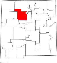 | |
| Towns | ||
| Villages | ||
| CDPs | ||
| Unincorporated community | ||
| Indian reservations | ||
| Footnotes | ‡This populated place also has portions in an adjacent county or counties | |