County surveyor

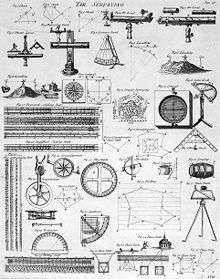

A county surveyor is a public official in many counties of the USA. At the bottom of this page are working "External Links" as at 4 November 2011 to websites of a selection of such County Surveyor's departments. Most of these officials are elected on the partisan ballot to four-year terms. They administer the county land survey records, re-establish and maintain the official government survey monuments, and review property boundaries surveys and subdivision plans. Other duties vary from state to state. Those marked with an asterisk (*) are nominated by the National Association of County Surveyors (NACS).[1]
NACS is part of the National Association of Counties of the USA (NACo).[2] The NACo website sets out its perception of the history of county government in the USA, tracing it to Anglo-Saxon England (initial division of land into holdings for government purposes called 'shires', hence 'shire-reeve', the origin of 'sheriff'), Anglo-Norman feudalism (renaming shires conquered by William I as 'counties' and establishing his allodial title to them via the Domesday Book survey), and the increasingly "plural executive structure" commissioned by his successors to the royal throne of England to defend the peace and enforce the complex of chivalric, common, and statutory laws of England (and of Wales from the reign of Edward I) up to the time of the first county government established in America (County of James City, Virginia).[3] This triad of origins is fundamental to understanding the organisation role that county surveying plays in the administration and development of the real estate of many states and nations around the world, even though sometimes it goes by other names. It was the framework that the King of England applied to his colonies in America and sufficiently successful as to have since been adopted by many other states.[4]
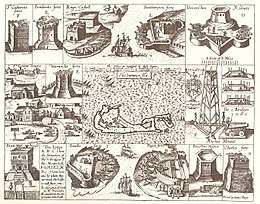
Chapter V 'The Development of an Extra-Legal Constitution', of 'English Local Government from the Revolution to the Municipal Corporations Act: The Parish and The County' by Sidney Webb and Beatrice Potter Web, describes the increasing chaos that began to prevail within this same period on the 'county surveying' front in England and Wales. Eventually, the military defence component of county surveying in the UK began to separate from the civil in 1791, with the Crown's 'Board of Ordnance' being commissioned to carry out a comprehensive survey of the South Coast of England[5] which, as a result of 'the last invasion of Britain 1797', at Fishguard in South West Wales[6] ultimately extended to all of the UK. With that shift in emphasis, county surveying began to concentrate more on its civil engineering and civic architecture roles, producing the historically famous British county surveyors such as Thomas Telford, John Loudon McAdam and John Nash;[7] the expression, "County Surveyor", became a UK statutory title (Bridges Act 1803); and, in England and Wales, its incumbents were appointed by elected councils as of the coming into effect of the Local Government Act 1888 rather than being Crown-appointed by Justices of the Peace.
The UK equivalent of NACS, namely, the County Surveyors Society (CSS) founded in 1885, was subsumed into the pluralistic Association of Directors of Environment, Economy, Planning and Transport (ADEPT) in 2010.[8]
External links
California
Colorado
Florida
Idaho
Indiana
- Marion County Surveyor
- Hamilton County Surveyor*
- St. Joseph County Surveyor
- Tippecanoe County Surveyor
Michigan
Minnesota
Nebraska
Oregon
- All County Surveyors*
- Clackamas County Surveyor*
- Douglas County Surveyor
- Malheur County Surveyor
- Multnomah County Surveyor
- Polk County Surveyor*
- Tillamook County Surveyor
- Yamhill County Surveyor*
Utah
Washington
Wisconsin
References
- ↑ "Welcome to the NACS Web Site". Uscounties.org. 2009-02-22. Archived from the original on 2012-09-19. Retrieved 2012-09-23.
- ↑ "The Voice of America's Counties". NACo. Archived from the original on 2012-09-23. Retrieved 2012-09-23.
- ↑ For related references to early county surveyor arrangements in Virginia see Kegley, Frederick Bittle. Kegley's Virginia Frontier: The Beginning of the Southwest : the Roanoke of Colonial Days, 1740-1783. originally published Roanoke, Virginia, 1938; reprinted Genealogical Publishing Co. Inc. Baltimore, 2003; Library of Congress Catalogue Card No. 2002114477. ISBN 0-8063-1717-5.
- ↑ "History of County Government Part I". Naco.org. Archived from the original on 2011-02-02. Retrieved 2012-09-23.
- ↑ "About Ordnance Survey, Britain's national mapping agency". Ordnancesurvey.co.uk. 2012-09-06. Archived from the original on 2012-10-05. Retrieved 2012-09-23.
- ↑ "Last Invasion". Fishguardonline.com. Retrieved 2012-09-23.
- ↑ 'The Life and Work of John Nash Architect' Summerson, John: 1980: George Allen & Unwin Ltd: England; 'John Nash - A Complete Catalogue': Mansbridge, Michael: 1991: Phaidon Press: London and New York; and 'John Nash Architect-Pensaer': Suggett, Richard: 1995: The Royal Commission on the Ancient and Historical Monuments of Wales, Aberystwyth; and, The National Library of Wales, Aberystwyth
- ↑ adeptnet.org.uk Archived November 19, 2016, at the Wayback Machine.