Cole-Noble District
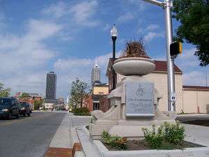
The Cole-Noble District is a neighborhood in Indianapolis, Indiana, United States. It is situated on the east side of downtown Indianapolis.
History
The name Cole-Noble District derives from two pieces of Eastside Indianapolis history. The Cole Motor Car Company (1909–1925) was located on Washington Street just east of College Avenue. The company produced the first four-door automobile and competed with the prestigious Cadillac. Noble refers to Noah Noble, who served as Indiana governor from 1831 to 1839. The Noble family farm once occupied a significant portion of the Cole-Noble area.
The Cole Noble District is known for a mix of Georgian, Federal, and Art Deco style architecture.
From 1974 to 2001, Market Square Arena was located at 300 East Market Street within the district. The indoor arena served as the home to the Indiana Pacers for 25 years, as well as numerous other entertainment events, before it was demolished in 2001. It is also known for being the site of Elvis Presley's last concert in 1977.
Residential
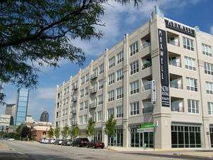
Since 2003, more than a handful of residential developments have been constructed in the neighborhood. Multi-family environments including townhouses, condominiums and apartments have been seen great success and have helped revitalize the neighborhood just East of Monument Circle. Individual communities include the Hudson, Clevelander, Packard, DeSoto, and Maxwell. Tadd Miller, the CEO of Indianapolis and Cole-Noble based development company Milhaus Development, LLC, was a development partner in each of these projects.
Business
Multiple local businesses are headquartered in the Cole Noble District. Among them is the Indianapolis-based restaurant Maxine's Chicken and Waffles, advertising and public relations firm TrendyMinds, and IT service provider RPM Technologies. Award winning brewery Sun King Brewery and Easley Winery are also located in the Cole-Noble District.
Borders of the District
- Northern - Miami Street
- Western - Alabama Street
- Southern - Railroad tracks south of Washington Street
- Eastern - I-65
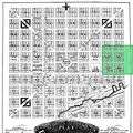 The Cole Noble District highlighted on the original Indianapolis plat