Col de la Croix Haute
- For other places sharing the name 'Pass of the cross' please see Col de la Croix (disambiguation)
| Col de la Croix-Haute | |
|---|---|
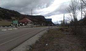 | |
| Elevation | 1,179 m (3,868 ft) |
| Traversed by | D1075 |
| Location | Isère/Drôme, France |
| Range | Alps |
| Coordinates | 44°43′26″N 05°40′39″E / 44.72389°N 5.67750°ECoordinates: 44°43′26″N 05°40′39″E / 44.72389°N 5.67750°E |
 Col de la Croix Haute Location of Col de la Croix Haute | |
Col de la Croix-Haute (el. 1179 m.) is a high mountain pass in the French Dauphiné Alps on the border of the Isère and Drôme departments, linking the towns of Clelles and Mens in the North with Lus-la-Croix-Haute in the South.
See also
This article is issued from
Wikipedia.
The text is licensed under Creative Commons - Attribution - Sharealike.
Additional terms may apply for the media files.