Cima del Redentore (Sibillini Mountains)
| Cima del Redentore | |
|---|---|
 | |
| Highest point | |
| Elevation | 2,448 m (8,031 ft) |
| Coordinates | 42°51′N 13°14′E / 42.850°N 13.233°ECoordinates: 42°51′N 13°14′E / 42.850°N 13.233°E |
| Geography | |
 Cima del Redentore Location in Italy | |
| Location | Marche/Umbria, Italy |
| Parent range | Monti Sibillini |
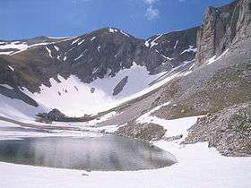
Cima del Redentore is a mountain of the Sibillini Mountains, a sub-range of the Apennines (Italy).
Geography
The mountain has an elevation of 2,448 metres above sea level. It's located on the border between the Italian regions of Marche and Umbria.
See also
This article is issued from
Wikipedia.
The text is licensed under Creative Commons - Attribution - Sharealike.
Additional terms may apply for the media files.