Chumpe (Cusco)
| Chumpe | |
|---|---|
| Jatunriti, Ñanaloma, Yanaloma | |
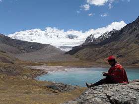 Chumpe and Lake Sibinacocha | |
| Highest point | |
| Elevation | 6,106 m (20,033 ft) |
| Coordinates | 13°43′32″S 71°04′53″W / 13.72556°S 71.08139°WCoordinates: 13°43′32″S 71°04′53″W / 13.72556°S 71.08139°W |
| Geography | |
 Chumpe Peru | |
| Location | Peru |
| Parent range | Andes, Vilcanota |
Chumpe[1][2] (possibly from Quechua chumpi: belt),[3] Jatunriti,[4] Ñanaloma[4] or Yanaloma[4] is a mountain in the Vilcanota mountain range in the Andes of Peru with 6,106 metres (20,033 ft) of elevation.[1][4] It is located in the Cusco Region, Canchis Province, Pitumarca District as well as in the Quispicanchi Province, Ocongate District. Chumpe lies north of Lake Sibinacocha.[1]
See also
References
- 1 2 3 Peru 1:100 000, Ocongate (28-t). IGN (Instituto Geográfico Nacional - Perú).
- ↑ lib.utexas.edu Map of the area showing "Nevado Chumpe"
- ↑ Teofilo Laime Acopa, Diccionario Bilingüe, Iskay simipi yuyay k'ancha, Quechua – Castellano, Castellano – Quechua: chumpi - s. Faja. Prenda que ciñe la cintura.
- 1 2 3 4 Biggar, John (2005). The Andes: A Guide for Climbers. Andes. p. 118. ISBN 9780953608720.
This article is issued from
Wikipedia.
The text is licensed under Creative Commons - Attribution - Sharealike.
Additional terms may apply for the media files.