Chintoor
| Chintoor | |
|---|---|
| Mandal | |
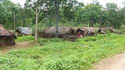 Settlements near Chintoor | |
 Chintoor Location in Andhra Pradesh, India  Chintoor Chintoor (India) | |
| Coordinates: 17°45′N 81°24′E / 17.75°N 81.4°ECoordinates: 17°45′N 81°24′E / 17.75°N 81.4°E | |
| Country |
|
| State | Andhra Pradesh |
| District | East Godavari |
| Elevation | 35 m (115 ft) |
| Languages | |
| • Official | Telugu |
| • Indigenous | Koya |
| Time zone | UTC+5:30 (IST) |
| Vehicle registration | AP |
| Climate | hot (Köppen) |
Chintoor or Chinturu is a mandal in East Godavari district of the Indian state Andhra Pradesh. It is located in Rampachodavaram revenue division.
Geography
Chinturu has an average elevation of 35 metres (118 ft). Geo Coordinates: 17°44'N 81°23'E. Chinturu is situated besides river Sabari. Sabari is sub river of Godavari river.
References
This article is issued from
Wikipedia.
The text is licensed under Creative Commons - Attribution - Sharealike.
Additional terms may apply for the media files.