Chiang Kham District
| Chiang Kham เชียงคำ | |
|---|---|
| Amphoe | |
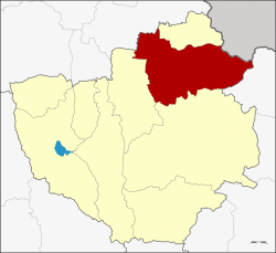 Amphoe location in Phayao Province | |
| Coordinates: 19°31′24″N 100°18′6″E / 19.52333°N 100.30167°ECoordinates: 19°31′24″N 100°18′6″E / 19.52333°N 100.30167°E | |
| Country | Thailand |
| Province | Phayao |
| Tambon | 10 |
| Muban | 135 |
| Area | |
| • Total | 784.061 km2 (302.728 sq mi) |
| Population (2015) | |
| • Total | 77,194 |
| • Density | 98.5/km2 (255/sq mi) |
| Time zone | UTC+7 (ICT) |
| Postal code | 56110 |
| Geocode | 5603 |
Chiang Kham (Thai: เชียงคำ, pronounced [t͡ɕʰīa̯ŋ kʰām]) is a district (amphoe) in the northeastern part of Phayao Province, northern Thailand.
Geography
Neighboring districts are (from the south clockwise) Pong, Chun of Phayao Province, Thoeng of Chiang Rai Province and Phu Sang of Phayao Province again. To the northeast is Xaignabouli Province of Laos.
Administration
Central administration
The Chiang Kham District is divided into 10 sub-districts (Tambon), which are further subdivided into 135 administrative villages (Muban).
| No. | Name | Thai | Villages | Pop.[1] |
|---|---|---|---|---|
| 1. | Yuan | หย่วน | 15 | 11,522 |
| 6. | Nam Waen | น้ำแวน | 14 | 7,133 |
| 7. | Wiang | เวียง | 10 | 5,672 |
| 8. | Fai Kwang | ฝายกวาง | 17 | 8,843 |
| 9. | Chedi Kham | เจดีย์คำ | 12 | 5,987 |
| 10. | Rom Yen | ร่มเย็น | 22 | 12,259 |
| 11. | Chiang Ban | เชียงบาน | 11 | 7,443 |
| 12. | Mae Lao | แม่ลาว | 14 | 6,485 |
| 13. | Ang Thong | อ่างทอง | 13 | 8,383 |
| 14. | Thung Pha Suk | ทุ่งผาสุข | 7 | 3,467 |
Local administration
There are four sub-district municipalities (Thesaban Tambon) in the district:
- Chiang Kham (Thai: เทศบาลตำบลเชียงคำ) consisting of parts of sub-district Yuan.
- Wiang (Thai: เทศบาลตำบลเวียง) consisting of sub-district Wiang.
- Fai Kwang (Thai: เทศบาลตำบลฝายกวาง) consisting of sub-district Fai Kwang.
- Yuan (Thai: เทศบาลตำบลหย่วน) consisting of parts of sub-district Yuan.
There are seven sub-district administrative organizations (SAO) in the district:
- Nam Waen (Thai: องค์การบริหารส่วนตำบลน้ำแวน) consisting of sub-district Nam Waen.
- Chedi Kham (Thai: องค์การบริหารส่วนตำบลเจดีย์คำ) consisting of sub-district Chedi Kham.
- Rom Yen (Thai: องค์การบริหารส่วนตำบลร่มเย็น) consisting of sub-district Rom Yen.
- Chiang Ban (Thai: องค์การบริหารส่วนตำบลเชียงบาน) consisting of sub-district Chiang Ban.
- Mae Lao (Thai: องค์การบริหารส่วนตำบลแม่ลาว) consisting of sub-district Mae Lao.
- Ang Thong (Thai: องค์การบริหารส่วนตำบลอ่างทอง) consisting of sub-district Ang Thong.
- Thung Pha Suk (Thai: องค์การบริหารส่วนตำบลทุ่งผาสุข) consisting of sub-district Thung Pha Suk.
References
- ↑ "Population statistics 2015" (in Thai). Department of Provincial Administration. Retrieved 2016-06-09.
External links
- amphoe.com (Thai)
This article is issued from
Wikipedia.
The text is licensed under Creative Commons - Attribution - Sharealike.
Additional terms may apply for the media files.