Cheonhwangsan (South Gyeongsang/Ulsan)
| Cheonhwangsan | |
|---|---|
 | |
| Highest point | |
| Elevation | 1,189 m (3,901 ft) |
| Coordinates | 35°34′N 128°58′E / 35.56°N 128.97°ECoordinates: 35°34′N 128°58′E / 35.56°N 128.97°E |
| Geography | |
 Cheonhwangsan | |
| Parent range | Taebaek Mountains |
| Korean name | |
| Hangul | 천황산 |
|---|---|
| Hanja | 天皇山 |
| Revised Romanization | Cheonhwangsan |
| McCune–Reischauer | Ch'ŏnhwangsan |
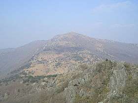
Cheonhwangsan is a mountain in South Korea. It sits on the boundary between the city of Ulsan and the city of Miryang, in the province of Gyeongsangnam-do. Cheonhwangsan has an elevation of 1,189 m (3,901 ft).[1] It is part of the Yeongnam Alps mountain range.
See also
Notes
- ↑ Yu 2007, p.589.
References
- Yu Jeong-yeol (2007). 한국의 산 여행 (Travel Guide to Korean Mountains). Seoul: 관동 상억연구회 (Kwandong). ISBN 978-89-958055-1-0.
External links
This article is issued from
Wikipedia.
The text is licensed under Creative Commons - Attribution - Sharealike.
Additional terms may apply for the media files.