Chandalar, Alaska
| Chandalar, Alaska | |
|---|---|
| Unincorporated community | |
 Chandalar, Alaska Location within the state of Alaska | |
| Coordinates: 67°15′5″N 148°10′34″W / 67.25139°N 148.17611°WCoordinates: 67°15′5″N 148°10′34″W / 67.25139°N 148.17611°W | |
| Country | United States |
| State | Alaska |
| Census Area | Yukon-Koyukuk |
| Government | |
| • State senator | Donny Olson (D) |
| • State rep. | Dean Westlake (D) |
| Elevation | 1,873 ft (571 m) |
| Time zone | UTC-9 (Alaska (AKST)) |
| • Summer (DST) | UTC-8 (AKDT) |
| Area code(s) | 907 |
Chandalar is an unincorporated community in Yukon-Koyukuk Census Area in the U.S. state of Alaska.
Chandalar is located about 200 miles north of Fairbanks and is at an elevation of 1,873 feet. The town was developed as a mining camp in about 1906 or 1907. A post office was established at Chandalar in 1908, but it was shut down in 1944. The community is served by the Chandalar Lake Airport and is not accessible by road. It was featured in the National Geographic show Life Below Zero.[1]
Climate
Chandalar has a continental subarctic climate (Köppen Dfc). The nearest weather station is at Chandalar Lake.
| Climate data for Chandalar | |||||||||||||
|---|---|---|---|---|---|---|---|---|---|---|---|---|---|
| Month | Jan | Feb | Mar | Apr | May | Jun | Jul | Aug | Sep | Oct | Nov | Dec | Year |
| Record high °F (°C) | 34 (1) |
38 (3) |
50 (10) |
56 (13) |
81 (27) |
87 (31) |
90 (32) |
90 (32) |
78 (26) |
59 (15) |
42 (6) |
31 (−1) |
90 (32) |
| Average high °F (°C) | −4.1 (−20.1) |
0.1 (−17.7) |
12.8 (−10.7) |
30.3 (−0.9) |
50.2 (10.1) |
65.0 (18.3) |
68.2 (20.1) |
61.0 (16.1) |
47.0 (8.3) |
24.5 (−4.2) |
5.0 (−15) |
−0.3 (−17.9) |
30.0 (−1.1) |
| Average low °F (°C) | −25.0 (−31.7) |
−23.7 (−30.9) |
−16.6 (−27) |
0.0 (−17.8) |
24.6 (−4.1) |
39.1 (3.9) |
41.9 (5.5) |
35.1 (1.7) |
25.4 (−3.7) |
6.8 (−14) |
−15.0 (−26.1) |
−21.3 (−29.6) |
6.0 (−14.4) |
| Record low °F (°C) | −74 (−59) |
−68 (−56) |
−57 (−49) |
−45 (−43) |
−25 (−32) |
20 (−7) |
25 (−4) |
11 (−12) |
−8 (−22) |
−36 (−38) |
−57 (−49) |
−63 (−53) |
−74 (−59) |
| Average precipitation inches (mm) | 0.43 (10.9) |
0.38 (9.7) |
0.34 (8.6) |
0.21 (5.3) |
0.56 (14.2) |
1.28 (32.5) |
1.52 (38.6) |
1.67 (42.4) |
1.22 (31) |
0.75 (19) |
0.4 (10) |
0.49 (12.4) |
9.24 (234.7) |
| Average snowfall inches (cm) | 6.7 (17) |
6.1 (15.5) |
4.3 (10.9) |
3.8 (9.7) |
0.8 (2) |
0 (0) |
0.1 (0.3) |
0 (0) |
1.6 (4.1) |
8.4 (21.3) |
6.4 (16.3) |
7.1 (18) |
45.2 (114.8) |
| Source: [2] | |||||||||||||
Demographics
| Historical population | |||
|---|---|---|---|
| Census | Pop. | %± | |
| 1920 | 32 | — | |
| 1930 | 62 | 93.8% | |
| U.S. Decennial Census[3] | |||
Chandalar first appeared on the 1920 U.S. Census as an unincorporated village. It appeared again in 1930, which was the last time it was separately returned on the census.
References
- ↑ "About Chandalar". National Geographic. Retrieved July 17, 2016.
- ↑ "CHANDALAR LAKE, ALASKA (501492)". Western Regional Climate Center. Retrieved July 17, 2016.
- ↑ "U.S. Decennial Census". Census.gov. Retrieved June 6, 2013.
External links
Municipalities and communities of Yukon–Koyukuk Census Area, Alaska, United States | ||
|---|---|---|
| Cities | 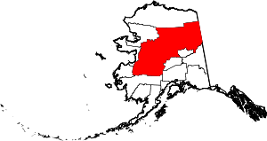 | |
| CDPs | ||
| Unincorporated communities | ||
| Ghost towns | ||