Cerro Las Minas
| Cerro Las Minas | |
|---|---|
| Montana de Celaque | |
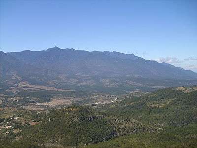 The Cordillera de Celaque | |
| Highest point | |
| Elevation | 2,870 m (9,420 ft) |
| Prominence | 2,069 m (6,788 ft) [1] |
| Listing | |
| Coordinates | 14°32′03″N 88°40′48″W / 14.53417°N 88.68000°WCoordinates: 14°32′03″N 88°40′48″W / 14.53417°N 88.68000°W [2] |
| Geography | |
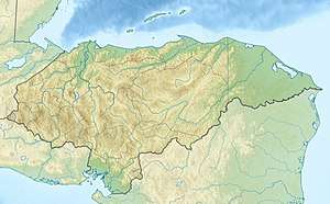 Cerro Las Minas Location of Cerro Las Minas in Honduras | |
| Location | Lempira Department, Honduras |
| Parent range | Cordillera de Celaque |
Cerro Las Minas is the highest mountain in Honduras. Cerro Las Minas is located in the rugged and relatively isolated Lempira Department in the western part of the country. A Honduran national park, the Celaque National Park, was established in 1987 for the mountain and some 266 square kilometres (65,730 acres) of surrounding territory.
It is part of the Cordillera de Celaque mountain range and is given the name "Pico Celaque, 2849m" on local 1:50,000 topographic mapping, but SRTM data suggests that 2870 m is more accurate.[3]
References
- ↑ "Cerro Las Minas, Honduras". Peakbagger.com. Retrieved 2014-05-19. This prominence value is based on an elevation of 2,849 m.
- ↑ Central America and Caribbean Ultra-Prominence Page". Peaklist.org. Retrieved 2014-05-19.
- ↑ Southworth, Jane; Catherine Tucker (August 2001). "The Influence of Accessibility, Local Institutions, and Socioeconomic Factors on Forest Cover Change in the Mountains of Western Honduras" (PDF). Mountain Research and Development. Boulder, CO: International Mountain Society and United Nations University. 21 (3): 276–283. doi:10.1659/0276-4741(2001)021[0276:TIOALI]2.0.CO;2. ISSN 0276-4741. OCLC 107067006.
External links
This article is issued from
Wikipedia.
The text is licensed under Creative Commons - Attribution - Sharealike.
Additional terms may apply for the media files.