Centralhatchee, Georgia
| Centralhatchee, Georgia | |
|---|---|
| Town | |
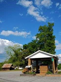 Centralhatchee in 2012 | |
 Location in Heard County and the state of Georgia | |
| Coordinates: 33°22′7″N 85°6′15″W / 33.36861°N 85.10417°WCoordinates: 33°22′7″N 85°6′15″W / 33.36861°N 85.10417°W | |
| Country | United States |
| State | Georgia |
| County | Heard |
| Government | |
| • Mayor | Barbie Crockett |
| Area | |
| • Total | 3.3 sq mi (8.5 km2) |
| • Land | 3.3 sq mi (8.5 km2) |
| • Water | 0 sq mi (0 km2) |
| Elevation | 846 ft (258 m) |
| Population (2010) | |
| • Total | 408 |
| • Estimate (2016)[1] | 389 |
| • Density | 125/sq mi (48.1/km2) |
| Time zone | UTC-5 (Eastern (EST)) |
| • Summer (DST) | UTC-4 (EDT) |
| ZIP Code | 30217 |
| Area code(s) | 706 |
| FIPS code | 13-15026[2] |
| GNIS feature ID | 0355098[3] |
Centralhatchee is a small town in Heard County, Georgia, United States. The population was 408 at the 2010 census.[4]
History
The town of Centralhatchee was originally a militia district known as "Black Ankle". The community of Glenloch, to the north, was known as "Blue Shin". The geographic configuration of these two communities, according to Indian legend, resembled the ankle and shin portion of the leg and foot. The town became part of Heard County when the county was formed from parts of Carroll, Troup and Coweta counties in 1830.
The town was chartered in 1903 with the name "Centralhatchee". The community takes its name from nearby Centralhatchee Creek.[5]
The Centralhatchee Baptist Church was organized in 1837 with 37 original members. The present building was built in 1896 on land given by Mr. Thomas Vaughn. The first pastor was Rev. William Daniel.
In 1907 the Centralhatchee Methodist Church was organized with Rev. R.F. Hodnett as the pastor.
From 1990 until 2004, Eley Loftin served as mayor of Centralhatchee; he now serves as a city councilman. Today, Barbie Crockett holds the mayoral position.
Geography
Centralhatchee is located in northern Heard County at 33°22′7″N 85°6′15″W / 33.36861°N 85.10417°W (33.368476, -85.104182).[6] Centralhatchee Creek, a south-flowing tributary of the Chattahoochee River, passes just outside of the town limits to the west.
U.S. Route 27, a four-lane highway, passes through the west side of town, leading south 7 miles (11 km) to Franklin, the Heard County seat, and north 16 miles (26 km) to Carrollton.
According to the United States Census Bureau, the town has a total area of 3.3 square miles (8.5 km2), all land.[4]
Demographics
| Historical population | |||
|---|---|---|---|
| Census | Pop. | %± | |
| 1910 | 119 | — | |
| 1920 | 151 | 26.9% | |
| 1930 | 176 | 16.6% | |
| 1940 | 201 | 14.2% | |
| 1950 | 239 | 18.9% | |
| 1960 | 174 | −27.2% | |
| 1970 | 186 | 6.9% | |
| 1980 | 240 | 29.0% | |
| 1990 | 301 | 25.4% | |
| 2000 | 383 | 27.2% | |
| 2010 | 408 | 6.5% | |
| Est. 2016 | 389 | [1] | −4.7% |
| U.S. Decennial Census[7] | |||
As of the census[2] of 2000, there were 383 people, 136 households, and 105 families residing in the town. The population density was 116.6 people per square mile (45.1/km²). There were 151 housing units at an average density of 46.0 per square mile (17.8/km²). The racial makeup of the town was 97.65% White, 2.09% African American, and 0.26% from two or more races. Hispanic or Latino of any race were 1.83% of the population.
There were 136 households out of which 43.4% had children under the age of 18 living with them, 64.0% were married couples living together, 7.4% had a female householder with no husband present, and 22.1% were non-families. 19.1% of all households were made up of individuals and 8.8% had someone living alone who was 65 years of age or older. The average household size was 2.82 and the average family size was 3.20.
In the town, the population was spread out with 31.9% under the age of 18, 6.3% from 18 to 24, 32.1% from 25 to 44, 22.5% from 45 to 64, and 7.3% who were 65 years of age or older. The median age was 32 years. For every 100 females, there were 84.1 males. For every 100 females age 18 and over, there were 90.5 males.
The median income for a household in the town was $37,813, and the median income for a family was $48,500. Males had a median income of $34,000 versus $22,500 for females. The per capita income for the town was $15,491. About 1.8% of families and 5.4% of the population were below the poverty line, including 3.5% of those under age 18 and 20.0% of those age 65 or over.
Notable person
- Roy Lee Johnson, R&B and soul songwriter, singer and guitarist
See also
References
- 1 2 "Population and Housing Unit Estimates". Retrieved June 9, 2017.
- 1 2 "American FactFinder". United States Census Bureau. Archived from the original on 2013-09-11. Retrieved 2008-01-31.
- ↑ "US Board on Geographic Names". United States Geological Survey. 2007-10-25. Retrieved 2008-01-31.
- 1 2 "Geographic Identifiers: 2010 Demographic Profile Data (G001): Centralhatchee town, Georgia". American Factfinder. U.S. Census Bureau. Retrieved May 18, 2017.
- ↑ Krakow, Kenneth K. (1975). Georgia Place-Names: Their History and Origins (PDF). Macon, GA: Winship Press. p. 38. ISBN 0-915430-00-2.
- ↑ "US Gazetteer files: 2010, 2000, and 1990". United States Census Bureau. 2011-02-12. Retrieved 2011-04-23.
- ↑ "Census of Population and Housing". Census.gov. Archived from the original on May 12, 2015. Retrieved June 4, 2015.
External links
![]()
Municipalities and communities of Heard County, Georgia, United States | ||
|---|---|---|
| Cities | 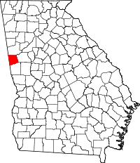 | |
| Town | ||
| Unincorporated communities | ||
| Footnotes | ‡This populated place also has portions in an adjacent county or counties | |