Cantaura
| Cantaura | ||
|---|---|---|
 | ||
| ||
.svg.png) Cantaura | ||
| Coordinates: 9°18′40″N 64°21′34″W / 9.31111°N 64.35944°WCoordinates: 9°18′40″N 64°21′34″W / 9.31111°N 64.35944°W | ||
| Country |
| |
| State | Anzoátegui | |
| Municipality | Pedro María Freites Municipality | |
| Founded | 20 August 1740 | |
| Elevation | 261 m (856 ft) | |
| Population | ||
| • Total | 42,000 | |
| • Demonym | Cantaurense | |
| Time zone | VST | |
| Postal code | 6007 | |
| Area code(s) | 0282 | |
| Climate | Aw | |
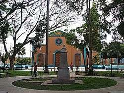
Cantaura (Spanish pronunciation: [kanˈtauɾa]) is a city in the state of Anzoátegui, Venezuela. It is the capital of Pedro María Freites Municipality.
See also
External links
| Wikimedia Commons has media related to Cantaura. |
This article is issued from
Wikipedia.
The text is licensed under Creative Commons - Attribution - Sharealike.
Additional terms may apply for the media files.