Kayseri
| Kayseri | |
|---|---|
| Metropolitan municipality | |
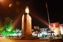
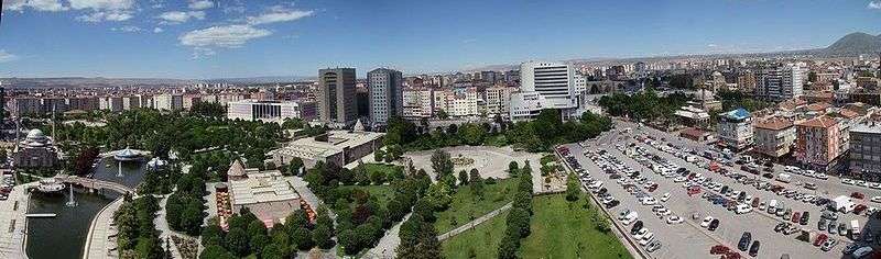
 Top: Kadir Has Stadium, 2nd left: Sivas Avenue, 2nd right: Atatürk Statue and the city walls of Kayseri in the background, 3rd: Tekin business district and Oto Park, Bottom left: Kayseri Castle at night, Bottom right: Kayseray. | |
 Kayseri Location of Kayseri, Turkey | |
| Coordinates: 38°44′N 35°29′E / 38.733°N 35.483°ECoordinates: 38°44′N 35°29′E / 38.733°N 35.483°E | |
| Country |
|
| Region | Central Anatolia |
| Province | Kayseri |
| Government | |
| • Mayor | Mustafa Çelik (AKP) |
| Elevation | 1,050 m (3,440 ft) |
| Population (2014)[1] | |
| • Metropolitan municipality | 1,061,942 |
| • Metro | 1,322,376 |
| Time zone | UTC+2 (EET) |
| • Summer (DST) | UTC+3 (EEST) |
| Postal code | 38x xx |
| Area code(s) | (+90) 352 |
| Licence plate | 38 |
| Website |
www.kayseri.bel.tr www.kayseri.gov.tr |
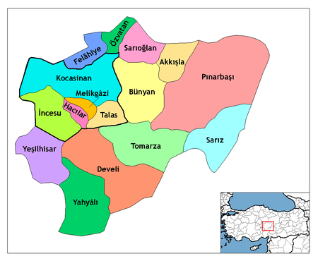
Kayseri (Turkish pronunciation: [ˈkajseɾi]) is a large industrialised city in Central Anatolia, Turkey. It is the seat of Kayseri Province. The city of Kayseri, as defined by the boundaries of Kayseri Metropolitan Municipality, is structurally composed of five metropolitan districts, the two core districts of Kocasinan and Melikgazi, and since 2004, also Hacılar, İncesu and Talas.
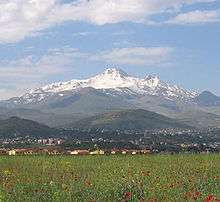
Kayseri is located at the foot of the extinct volcano Mount Erciyes that towers 3,916 metres (12,848 feet) over the city. The city is often cited in the first ranks among Turkey's cities that fit the definition of Anatolian Tigers.[2]
The city retains a number of historical monuments, including several from the Seljuk period. While it is generally visited en route to the international tourist attractions of Cappadocia, Kayseri has many attractions in its own right: Seljuk and Ottoman era monuments in and around the city centre, Mount Erciyes as a trekking and alpinism centre, Zamantı River as a rafting centre, and the historic sites of Kültepe, Ağırnas, Talas and Develi. Kayseri is served by Erkilet International Airport and is home to Erciyes University.
According to the Turkish Statistical Institute, as of 2011 the city of Kayseri had a population of 844,656; while Kayseri Province had a population of 1,234,651.[3][4]
Etymology
Kayseri was originally called Mazaka or Mazaca by the Hattians and was known as such to Strabo, during whose time it was the capital of the Roman province of Cilicia, known also as Eusebia at the Argaeus (Εὐσέβεια ἡ πρὸς τῶι Ἀργαίωι in Greek), after Ariarathes V Eusebes, King of Cappadocia (163–130 BC). The name was changed again by Archelaus (d. 17 AD), last King of Cappadocia (36 BC–14 AD) and a Roman vassal, to "Caesarea in Cappadocia" (to distinguish it from other cities with the name Caesarea in the Roman Empire) in honour of Caesar Augustus, upon his death in 14 AD. When the Muslim Arabs arrived, they adapted the pronunciation to their writing resulting in Kaisariyah (note that letter C in classical Latin was pronounced K), and this eventually became Kayseri when the Seljuk Turks took control of the city in circa 1080, remaining as such ever since.[5]
History
Ancient history
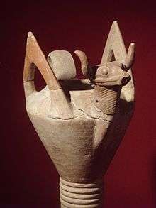
The city has been continuously inhabited since perhaps c. 3000 BC with the establishment of the ancient trading colony at Kültepe (Ash Mountain) which is associated with the Hittites. The city has always been a vital trade centre as it is located on major trade routes, particularly along what was called the Great Silk Road. Kültepe, one of the oldest cities in Asia Minor, lies nearby.
As Mazaca, the city served as the residence of the kings of Cappadocia. In ancient times, it was on the crossroads of the trade routes from Sinope to the Euphrates and from the Persian Royal Road that extended from Sardis to Susa during the over 200 years of Achaemenid Persian rule. In Roman times, a similar route from Ephesus to the East also crossed the city.
The city stood on a low spur on the north side of Mount Erciyes (Mount Argaeus in ancient times). Only a few traces of the ancient site survive in the old town.
Hellenistic Times
The city was the centre of a satrapy under Persian rule until it was conquered by Perdikkas, one of the generals of Alexander the Great when it became the seat of a transient satrapy by another of Alexander's former generals, Eumenes of Cardia. The city was subsequently passed to the Seleucid empire after the battle of Ipsus but became once again the centre of an autonomous Greater Cappadocian kingdom under Ariarathes III of Cappadocia in around 250 BC. In the ensuing period, the city came under the sway of Hellenistic influence, and was given the Greek name of Eusebia (Greek: Ευσέβεια) in honor of the Cappadocian king Ariarathes V Eusebes Philopator of Cappadocia (163–130 BC). The new name of Caesarea (Greek: Καισάρεια), by which it has since been known, was given to it by the last Cappadocian King Archelaus[5] or perhaps by Tiberius.[6]
Roman and Byzantine Rule
The city passed under formal Roman rule in 17 BC.
Caesarea was destroyed by the Sassanid king Shapur I after his victory over the Emperor Valerian I in AD 260. At the time it was recorded to have around 400,000 inhabitants. The city gradually recovered, and became home to several early Christian saints: saints Dorothea and Theophilus the martyrs, Gregory of Nazianzus, Gregory of Nyssa and Basil of Caesarea. In the 4th century, bishop Basil established an ecclesiastic centre on the plain, about one mile to the northeast, which gradually supplanted the old town.[7] It included a system of almshouses, an orphanage, old peoples' homes, and a leprosarium (leprosy hospital). The city's bishop, Thalassius, attended the [8] Second Council of Ephesus and was suspended from the Council of Chalcedon [9]
A Notitia Episcopatuum composed during the reign of Byzantine Emperor Heraclius in about 640 lists 5 suffragan dioceses of the metropolitan see of Caesarea. A 10th-century list gives it 15 suffragans.[10] In all the Notitiae Caesarea is given the second place among the metropolitan sees of the patriarchate of Constantinople, preceded only by Constantinople itself, and its archbishops were given the title of protothronos, meaning "of the first see" (after that of Constantinople). More than 50 first-millennium archbishops of the see are known by name, and the see itself continued to be a residential see of the Eastern Orthodox Church until 1923, when by order of the Treaty of Lausanne all members of that Church(Greeks)were deported from what is now Turkey.[11][12][13] Caesarea was also the seat of an Armenian diocese.[14] No longer a residential bishopric, Caesarea in Cappadocia is today listed by the Catholic Church as a titular see of the Armenian Catholic Church and the Melkite Catholic Church.[15]
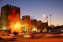
A portion of Basil's new city was surrounded with strong walls, and it was turned into a fortress by Justinian. Caesarea in the 9th century became a Byzantine administrative centre as the capital of the Byzantine Theme of Charsianon. The 1500-year-old Kayseri Castle, built initially by the Byzantines, and expanded by the Seljuks and Ottomans, is still standing in good condition in the central square of the city.
Islamic Era
.JPG)
The Arab general (and later the first Umayyad Caliph) Muawiyah invaded Cappadocia and took Caesarea from the Byzantines temporarily in 647.[16] The city was called Kaisariyah (قيصرية) by the Arabs, and later Kayseri (قیصری) by Seljuk Turks,[5] when it was captured by Alp Arslan in 1067. The forces of the latter demolished the city and massacred its population.[17] The shrine of Saint Basil was also sacked after the fall of the city.[18] As a result, the city remained uninhabited for the next half century.[17] Later, during 1074–1178 the area came under the control of the Danishmendids and rebuilt the city in 1134.[19] The Anatolian Seljuk Sultanate controlled the city during the period 1178–1243 and became one of their most prominent centers, until it fell to the Mongols in 1243. Within the walls lies the greater part of Kayseri, rebuilt between the 13th and 16th centuries. Kayseri was successively ruled by Eretnids. The city finally became Ottoman in 1515. It was sanjak center initially in Rum Eyalet (1515–1521), finally in Ankara Vilayet (Founded as Bozok Eyalet) (1839–1923).
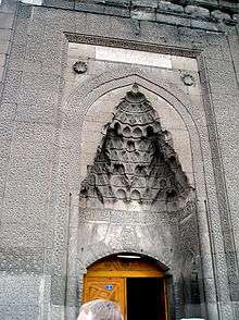
Thus, there were three golden-age periods for Kayseri. The first, dating to 2000 BC, was when the city was a trade post between the Assyrians and the Hittites. The second golden age came during the Roman rule (1st to 11th centuries). The third golden age was during the reign of Seljuks (1178–1243), when the city was the second capital of the state. The short-lived Seljuk rule left a large number of historic landmarks; historic buildings such as the Hunad Hatun Mosque complex, Kilij Arslan Mosque, The Grand Mosque and Gevher Nesibe Hospital.
Modern era
The Grand Bazaar dates from the latter part of the 1800s, but the adjacent caravanserai (where merchant traders gathered before forming a caravan) dates from around 1500. The town's older districts (which were filled with ornate mansion-houses mostly dating from the 18th and 19th centuries) were subjected to wholesale demolitions starting in the 1970s.[20]
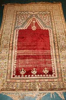
The building that hosts the Kayseri lyceum was arranged to host the Turkish Grand National Assembly during the Turkish War of Independence when the Greek army had advanced very close to Ankara, the base of the Turkish National Movement. Today the city is famous for its carpet sellers.
Geography
Climate
Kayseri has a cold semi-arid climate, Köppen climate classification (BSk) with cold, snowy winters and hot, dry summers with cool nights due to Kayseri's high elevation. Rainfall occurs mostly during the spring, early summer and late autumn.
| Climate data for Kayseri (1960–2012) | |||||||||||||
|---|---|---|---|---|---|---|---|---|---|---|---|---|---|
| Month | Jan | Feb | Mar | Apr | May | Jun | Jul | Aug | Sep | Oct | Nov | Dec | Year |
| Record high °C (°F) | 18.0 (64.4) |
20.1 (68.2) |
27.6 (81.7) |
31.2 (88.2) |
33.6 (92.5) |
36.0 (96.8) |
40.7 (105.3) |
40.0 (104) |
36.0 (96.8) |
32.6 (90.7) |
25.5 (77.9) |
21.0 (69.8) |
40.7 (105.3) |
| Average high °C (°F) | 4.1 (39.4) |
6.0 (42.8) |
11.7 (53.1) |
17.6 (63.7) |
22.4 (72.3) |
26.7 (80.1) |
30.6 (87.1) |
30.6 (87.1) |
26.5 (79.7) |
20.3 (68.5) |
12.7 (54.9) |
6.4 (43.5) |
18 (64.4) |
| Daily mean °C (°F) | −1.8 (28.8) |
0.0 (32) |
5.0 (41) |
10.6 (51.1) |
15.0 (59) |
19.1 (66.4) |
22.6 (72.7) |
22.0 (71.6) |
17.1 (62.8) |
11.6 (52.9) |
5.0 (41) |
0.5 (32.9) |
10.6 (51) |
| Average low °C (°F) | −7.0 (19.4) |
−5.4 (22.3) |
−1.3 (29.7) |
3.3 (37.9) |
6.7 (44.1) |
9.7 (49.5) |
12.0 (53.6) |
11.3 (52.3) |
7.2 (45) |
3.6 (38.5) |
−1.1 (30) |
−4.4 (24.1) |
2.9 (37.2) |
| Record low °C (°F) | −31.4 (−24.5) |
−31.2 (−24.2) |
−28.1 (−18.6) |
−11.6 (11.1) |
−6.9 (19.6) |
−0.5 (31.1) |
2.9 (37.2) |
1.4 (34.5) |
−3.2 (26.2) |
−12.2 (10) |
−17.8 (0) |
−26.0 (−14.8) |
−31.4 (−24.5) |
| Average precipitation mm (inches) | 33.6 (1.323) |
33.6 (1.323) |
42.5 (1.673) |
57.2 (2.252) |
56.6 (2.228) |
35.9 (1.413) |
14.3 (0.563) |
8.5 (0.335) |
12.9 (0.508) |
34.8 (1.37) |
37.2 (1.465) |
39.0 (1.535) |
406.1 (15.988) |
| Average rainy days | 11.6 | 11.6 | 12.3 | 13.5 | 13.5 | 8.4 | 2.8 | 2.4 | 4.2 | 7.9 | 9.3 | 11.6 | 109.1 |
| Average snowy days | 9 | 9 | 6 | 1 | 0 | 0 | 0 | 0 | 0 | 0 | 3 | 8 | 36 |
| Average relative humidity (%) | 76 | 72 | 62 | 58 | 56 | 50 | 44 | 44 | 47 | 58 | 69 | 77 | 59 |
| Mean monthly sunshine hours | 89.9 | 112 | 151.9 | 183 | 254.2 | 309 | 362.7 | 350.3 | 270 | 201.5 | 138 | 80.6 | 2,503.1 |
| Source #1: Devlet Meteoroloji İşleri Genel Müdürlüğü[21] | |||||||||||||
| Source #2: Weather2[22] | |||||||||||||
Political structure
The city of Kayseri consists of the following metropolitan districts:
| Name |
|---|
| Akkışla |
| Bünyan |
| Develi |
| Felâhiye |
| Hacılar |
| İncesu |
| Kocasinan |
| Melikgâzi |
| Özvatan |
| Pınarbaşı |
| Sarıoğlan |
| Sarız |
| Talas |
| Tomarza |
| Yahyâlı |
| Yeşilhisar |
Economy
Kayseri received notable public investments in the 1920s and 1930s. Sumer Textile and Kayseri Tayyare Fabrikasi (airplane manufacturer) were set up here during the post Republican Era with the help of German and particularly Russian experts. The latter manufactured the first aircraft "made in Turkey" in the 1940s. After the 1950s, the city suffered from a decrease in the amount of public investment. It was, however, during the same years that Kayseri businessmen and merchants became transformed into countrywide capitalists. Families such as Sabancı, Has, Dedeman, Hattat, Kurmel, Özyeğin, Karamanlargil and Özilhan who started out as small-scale merchants in the city of Kayseri became prominent actors in the Turkish economy. These families set up their headquarters in cities such as Istanbul and Adana, nevertheless often coming back to Kayseri to invest.

Thanks to the economic liberalisation policies introduced in the 1980s, a new wave of merchants and industrialists from Kayseri joined their predecessors. Most of these new industrialists choose Kayseri as base of their operations. As a consequence of better infrastructures, the city achieved a remarkable industrial growth since 2000 and is one of the key cities that characterises the class of Anatolian Tigers, with a favourable environment present especially for small and medium enterprises.
The pace of growth of the city was so fast that in 2004 the city applied to the Guinness Book of World Records for the most new manufacturing industries started in a single day: 139 factories. Kayseri also has emerged as one of the most successful furniture-making hub in Turkey earned more than a billion dollars in export revenues in 2007.
Kayseri Free Zone established in 1998, today has more than 43 companies with an investment of 140 million dollars. The Zone's main business activities including; production, trading, warehouse management, mounting and demounting, assembly-disassembly, merchandising, maintenance and repair, engineering workshops, office and workplace rental, packing-repacking, banking and insurance, leasing, labelling and exhiption facilities. Kayseri FTZ with cost of $8 per square meter is one of the lowest cost land free zones in the world.[23]
Some social scientists trace this economic success to a modernist Islamic outlook referred to as "Islamic Calvinism" which they say is taking root in Kayseri.[24]
Transport


The city is served by Erkilet International Airport and the International Air Transport Association symbol for the airport is ASR. The airport is a short distance from the centre of Kayseri. There are several flights per day to Istanbul, Turkey's premium air transportation hub. Since the air transportation industry in Turkey is growing quickly, new flights from Kayseri to several other localities inside and outside Turkey are soon to be expected.
Kayseri is connected to the rest of country with railway service. There are four trains per day to Ankara. To the east there are two branches: one to Kars, and another to Tatvan on the west shore of Lake Van.
As the city is located in central Turkey, car and bus transportation are highly efficient. It takes approximately three hours to reach Ankara, approximately three hours to Mediterranean shores and 45 minutes to Cappadocia. The symbol of the city, Mount Erciyes, which is a notable ski centre in winters and accessible for trekking in summertime, is at only 30 minutes' drive from the city centre.
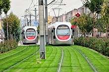
The transportation within the city relies mainly on buses, and personal vehicles. A light rail transit (LRT) system called Kayseray was constructed and completed by the end of 2009.
Sports
The city has two professional football teams competing in the top-flight of Turkish football: Kayserispor and Kayseri Erciyesspor, both playing in the Spor Toto Super League, making Kayseri one of the only two cities having more than one team in Spor Toto Süper Lig 2013–14, the other being Istanbul. Kayserispor is the only Turkish team to have won the UEFA Intertoto Cup, in 2006.
The Erciyes Ski Resort at Mount Erciyes is one of the largest ski resorts in Turkey.
Sports venues
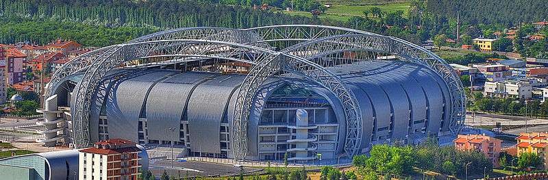
- Kadir Has Stadium is a new generation post-modern stadium, it is located in the outskirts of the city. The all-seater stadium has the capacity of 33,000 spectators and it is totally covered. It is shared by the two Kayserian football clubs, as before, and the Kadir Has Stadium is the new home for both teams. The stadium and surrounding sports complex are served by the light-rail system, Kayseray, making access to the complex easier for traveling locals. It was completed in early 2009. The inauguration of stadium was made with a Kayserispor – Fenerbahce league match. Kadir Has Stadium was one of the 8 host stadiums of the 2013 FIFA U-20 World Cup, The stadium hosted the opening ceremony followed by the opening match between Cuba versus the Republic of Korea.
- Kadir Has Sports Arena is an indoor arena complex, which was opened in 2008. It has a seating capacity of 7,200 people. Together with Kadir Has Stadium, it is a part of the Kayseri Kadir Has Sports Complex, one of the newest sports complexes in Turkey. The arena was one of the venues of the 2010 FIBA World Championship.
Education
Kayseri High School (Kayseri Lisesi), established in 1893, is one of the oldest high schools in Turkey. Küçükçalık Anatolian High School (Nuh Mehmet Küçükçalık Anadolu Lisesi), established in 1984, which is providing education in English, is among the first ones in Turkey. Kılıçarslan is a private high school in Kayseri, In 2000, it became a sister school with Anatolia College in Thessaloniki. TED Kayseri College in Kocasinan district of the city a Private, non-profit, co-educational kindergarten, primary, junior high, and high school is the third largest school in TED, since its foundation in 1966 thousands of students have graduated from the school.
Kayseri is home to 2 state and 1 private universities.
- Abdullah Gül University a newly established state university. AGU is the first state university in Turkey to have, as part of its constitution, legal provision for support by a foundation whose entire efforts are solely dedicated to the work of the University. The university started enrolling students in 2013.
- Erciyes University is the largest university in the city founded in 1978 and is a continuation of a number of schools founded in 1206 and 1956.[25] currently serving with 13 faculties, 6 colleges and 7 vocational schools. The university employs more than 3100 academic and administrative personnel and enrolls 41,225 students. The university is highly developed and thus well organised compared to the standards of Turkey.
- Nuh Naci Yazgan University is a private university founded in 2009 with 4 faculties, 2 colleges and 1 vocational school.
Cuisine
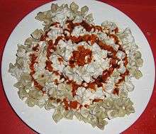
Kayseri is renowned for its culinary specialities such as mantı, pastırma and sucuk. Mantı is the most popular dish in Kayseri for the local people and tourists. Another speciality is stuffed zucchini flowers made with Köfte, garlic and spices. Nevzine is a traditional dessert.
Images from Kayseri
 Kayseri Bürüngüz Mosque and Mount Erciyes
- Kayseri Sahabiye Medresesi
 Kayseri in 1897
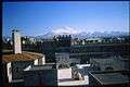 Kayseri with the Mount Erciyes in the background
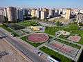 Tuna Park Kayseri
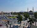 Kayseri Square
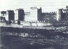
 Remains of the city wall
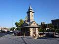 Kayseri clock Tower
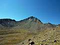 Mount Erciyes Kayseri
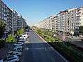 Sivas Avenue Kayseri
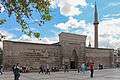 Hunat Hatun Medresesi dating from 1238
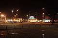 Republic Square at night
 Erciyes University
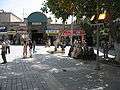 Kayseri Square
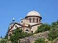 Former Greek church in Talas, now a mosque
Notable people from Kayseri
- Khachatur Kesaratsi, (1590-1646) Armenian archbishop, founder of the first printing press in Iran
- Mihran Kassabian, (1870-1910) Armenian radiologist
International relations
Twin towns — Sister cities
Kayseri is twinned with:
|
Europe |
Asia |
See also
References
- ↑ "Turkey: Major cities and provinces". citypopulation.de. Archived from the original on 2015-02-24. Retrieved 2015-02-08.
- ↑ ESI. "Islamic Calvinists: Change and Conservatism in Central Anatolia" (PDF). European Stability Initiative, Berlin. Archived (PDF) from the original on 2005-12-10. Retrieved 2005-09-19.
- ↑ "2011". citypopulation.de. Archived from the original on 14 January 2017. Retrieved 29 April 2018.
- ↑ "Türkiye İstatistik Kurumu". Archived from the original on 2016-03-04.
- 1 2 3 Everett-Heath, John (2005). "Kayseri". Concise Dictionary of World Place-Names. Oxford University Press. Retrieved 2007-12-11.
- ↑ "CATHOLIC ENCYCLOPEDIA: Caesarea". Archived from the original on 2007-07-02.
- ↑ Tore Kjeilen (2005-10-17). "Kayseri – LookLex Encyclopaedia". Lexicorient.com. Archived from the original on 2012-03-14. Retrieved 2012-08-13.
- ↑ Richard Price, Michael Gaddis The Acts of the Council of Chalcedon, Volume 1 p31.
- ↑ Richard Price, Michael Gaddis, The Acts of the Council of Chalcedon, Volume 1 p36.
- ↑ Heinrich Gelzer, Ungedruckte und ungenügend veröffentlichte Texte der Notitiae episcopatuum, in: Abhandlungen der philosophisch-historische classe der bayerische Akademie der Wissenschaften, 1901, p. 536, nº 77–82, and pp. 551–552, nnº 106–121.
- ↑ Pius Bonifacius Gams, Series episcoporum Ecclesiae Catholicae Archived 2015-03-08 at Wikiwix, Leipzig 1931, p. 440
- ↑ Michel Lequien, Oriens christianus in quatuor Patriarchatus digestus, Paris 1740, Vol. I, coll. 367–390
- ↑ Raymond Janin, v. 2. Césarée de Cappadoce, in Dictionnaire d'Histoire et de Géographie ecclésiastiques, vol. XII, Paris 1953, coll. 199–203
- ↑ "Caesarea". Catholic Encyclopedia. Archived from the original on 2007-07-02.
- ↑ Annuario Pontificio 2013 (Libreria Editrice Vaticana 2013 ISBN 978-88-209-9070-1), p. 867
- ↑ Ostrogorsky, George. History of the Byzantine State. New Jersey: Rutgers University Press, 1969. Pg 116.
- 1 2 Ash, John (2006). A Byzantine journey ([2. ed.] ed.). London: Tauris Parke Paperbacks. p. 167. ISBN 9781845113070.
In that year the Turks captured Caesarea, the chief city of eastern Cappadocia, burnt it to the ground, massacred its inhabitants and descrated the great shrine of Saint Basil.
- ↑ Vaughan, Louis Bréhier ; translated by Margaret (1977). The life and death of Byzantium. Amsterdam: North-Holland Pub. Co. p. 193. ISBN 9780720490084.
In the spring of 1067 he invaded the Pontus and penetrated as far as Caesarea in Cappadocia which he demolished
- ↑ Speros Vryonis, The Decline of Medieval Hellenism in Asia Minor and the Process of Islamization from the Eleventh through the Fifteenth Century' Archived 2017-02-02 at the Wayback Machine. (University of California Press, 1971), p. 155
- ↑ www.virtualani.org. "Armenian Architecture – VirtualANI – The Traditional Houses of Kayseri". Archived from the original on 2007-05-23.
- ↑ "İl ve İlçelerimize Ait İstatistiki Veriler- Meteoroloji Genel Müdürlüğü". Dmi.gov.tr. Archived from the original on 2012-08-09. Retrieved 2012-08-13.
- ↑ "December Climate History for Kayseri | Local | Turkey". Myweather2.com. Archived from the original on 2012-03-20. Retrieved 2012-08-13.
- ↑ "KAYSER -Kayseri Serbest Bölgesi". Archived from the original on 2013-12-05.
- ↑ "Chronology of all ESI publications – Reports – ESI". Esiweb.org. 2005-09-19. Archived from the original on 2012-06-03. Retrieved 2012-08-13.
- ↑ Tore Kjeilen (2005-10-17). "Kayseri – LookLex Encyclopaedia". I-cias.com. Archived from the original on 2012-08-02. Retrieved 2012-08-13.
- ↑ "Mostar Gradovi prijatelji" [Mostar Twin Towns]. Grad Mostar [Mostar Official City Website] (in Bosnian). Archived from the original on 2013-11-06. Retrieved 2017-02-21.
- ↑ http://www.nation.com.pk/pakistan-news-newspaper-daily-english-online/Regional/Lahore/15-Jan-2010/Punjab-Turkey-sign-four-MoUs%5Bpermanent+dead+link%5D
External links
| Wikivoyage has a travel guide for Kayseri. |
| Wikimedia Commons has media related to Kayseri. |
| Wikisource has the text of the 1905 New International Encyclopedia article Kaisarieh. |
| Rank | Name | Province | Pop. | Rank | Name | Province | Pop. | ||
|---|---|---|---|---|---|---|---|---|---|
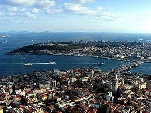 Istanbul  Ankara |
1 | Istanbul | Istanbul | 14,744,519 | 11 | Mersin | Mersin | 1,005,455 | 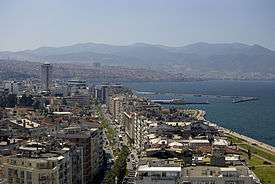 İzmir 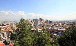 Bursa |
| 2 | Ankara | Ankara | 4,871,884 | 12 | Urfa | Şanlıurfa | 921,978 | ||
| 3 | İzmir | İzmir | 2,938,546 | 13 | Eskişehir | Eskişehir | 752,630 | ||
| 4 | Bursa | Bursa | 2,074,799 | 14 | Denizli | Denizli | 638,989 | ||
| 5 | Adana | Adana | 1,753,337 | 15 | Kahramanmaraş | Kahramanmaraş | 632,487 | ||
| 6 | Gaziantep | Gaziantep | 1,663,273 | 16 | Samsun | Samsun | 625,410 | ||
| 7 | Antalya | Antalya | 1,311,471 | 17 | Malatya | Malatya | 618,831 | ||
| 8 | Konya | Konya | 1,130,222 | 18 | İzmit | Kocaeli | 570,077 | ||
| 9 | Kayseri | Kayseri | 1,123,611 | 19 | Adapazarı | Sakarya | 492,027 | ||
| 10 | Diyarbakır | Diyarbakır | 1,047,286 | 20 | Erzurum | Erzurum | 422,389 | ||