Upper Atbara and Setit Dam Complex
| Upper Atbara and Setit Dam Complex | |
|---|---|
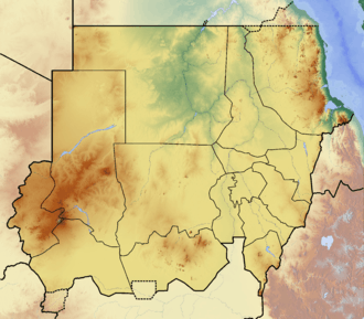 Location of Upper Atbara and Setit Dam Complex in Sudan | |
| Location | Sudan |
| Coordinates | 14°16′36″N 35°53′49″E / 14.27667°N 35.89694°ECoordinates: 14°16′36″N 35°53′49″E / 14.27667°N 35.89694°E |
| Construction began | 2011 |
| Opening date | 2017 |
| Construction cost | US$ 1.9 billion |
| Dam and spillways | |
| Impounds | Atbarah River/Setit River |
| Height |
Rumela: 55 m (180 ft) Burdana: 50 m (164 ft) |
| Length | 13 km (8.1 mi) |
| Spillway capacity |
Rumela: 4,900 m3/s (170,000 cu ft/s) Burdana: 9,400 m3/s (331,958 cu ft/s) |
| Reservoir | |
| Total capacity | 2,700×106 m3 (2,200,000 acre⋅ft) |
| Normal elevation | 517.5 m (1,698 ft) |
| Power Station | |
| Turbines |
Rumela: 3 x 40 MW (54,000 hp) Francis-type Burdana: 3 x 5 MW bulb |
| Installed capacity | 135 MW (181,000 hp)[1] |
| Annual generation | 380 GWh (1,400 TJ) annually (est.) |
The Upper Atbara and Setit Dam Complex is a twin dam complex currently under construction and comprising Rumela Dam on Upper Atbarah River and Burdana Dam on Setit River in Eastern Sudan. The site of the twin dam is located 20 kilometres (12 mi) upstream from the junction of the Atbarah and Setit rivers and about 80 kilometres (50 mi) to the south of the Khashm el-Girba Dam. Construction began in 2011 and both dams are expected to be complete by March 2016.[2]
Design
The Rumela Dam on Atbarah will have a height of 55 metres (180 ft) and the Burdana Dam on Setit will have a height of 50 metres (160 ft). The two dams will be connected and have a total length of 13 kilometres (8.1 mi). The twin dam complex will thus have a joined reservoir with a storage capacity of about 2.7 billion cubic metres (2,200,000 acre⋅ft) of water. The maximum filling level will be 517.5 metres (1,698 ft) above sea level. The project includes the construction of hydropower stations on both Rumela and Burdana Dams with a total installed capacity of 135 MW, which should be capable of producing 380 gigawatt-hours (1,400 TJ) per year.
Project aims
The objective of the project is to support the development of Eastern Sudan, through enhancement of agriculture production, generation of hydropower and potable water utilizing locally available water resources from the Atbara and Setit rivers. The project also aims to increase agriculture production in the New Halfa area currently irrigated by Khashm El-Girba Dam, and the development of new land consisting of 150,000 hectares (370,000 acres) in Upper Atbara. Additionally, the dams will provide flood protection measures along the river banks through the regulation of the river flow in the project area.
Project costs
The total cost of the dam complex is estimated at $1.9 billion, of which $838 million is for the construction of the dams by the China Three Gorges Corporation (CTG) and its overseas project contracting subsidiary China Water and Electric Corporation (CWE).[3]
In addition to the project implementation costs are hydroelectric and electric costs, technical and consultancy service costs, land owning and population resettlement costs and project implementation management and supervision costs by Sudan's Dams Implementation Unit (DIU). The consultant for the project is the French company Sogreah, which also designed and supervised the implementation of the Khashm el-Girba Dam during the 1960s. The Rumela and Burdana dam designs were revised by the German Company Lahmeyer International, the same company that allegedly revised and supervised the design of the controversial Merowe Dam.
Archaeology
Archaeological surveys were undertaken in the area to be flooded by the National Corporation for Antiquities and Museums during the summer of 2011.[4]
References
- ↑ "Upper Atbara - Dam complex" (PDF). Sogreah Consultants. Retrieved 8 February 2013.
- ↑ "Twin Dam in Eastern Sudan: Rumela Dam on Upper Atbara and Burdana Dam on Setit". Preserve the Middle Nile. Retrieved 8 February 2013.
- ↑ http://english.people.com.cn/90001/90778/90861/6944255.html
- ↑ http://www.sudanvisiondaily.com/modules.php?name=News&file=article&sid=66957