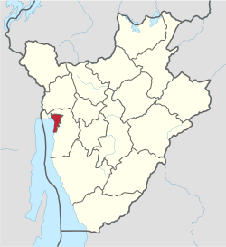
Bujumbura Mairie Province
| Bujumbura Mairie Province | |
|---|---|
| Province | |
 | |
| Country | Burundi |
| Capital | Bujumbura |
| Area | |
| • Total | 86.52 km2 (33.41 sq mi) |
| Population (2008 census) | |
| • Total | 497,166 |
| • Density | 5,700/km2 (15,000/sq mi) |
Bujumbura Mairie Province is one of the eighteen provinces of Burundi. It consists entirely of the city of Bujumbura, Burundi's capital.
History
It was created by splitting Bujumbura Province into Bujumbura Mairie Province and Bujumbura Rural Province.
Administrative subdivisions
The city of Bujumbura is divided into 13 urban communes (neighborhoods), per Ministerial Order No. 530/1279 of 22 September 2005.[1]
- Buterere
- Quarters: Buterere I, Buterere II A, Buterere II B, Kabusa, Kiyange, Maramvya, Mubone, Mugaruro, Kiyange(fr)
- Buyenzi
- Quarters: I, II, III, IV, V, VI, VII
- Bwiza
- Quarters: Bwiza I, Bwiza II, Bwiza III, Bwiza IV, Kwijabe I, Kwijabe II, Kwijabe III
- Cibitoke
- Quarters: I, II, III, IV, V, VI, VII
- Gihosha
- Quarters: Gasenyi, Gihosha, Gikungu, Kigobe, Mutanga-Nord, Muyaga, Nyabagere, Taba, Winterekwa
- Kamenge
- Quarters: Gikizi, Gituro, Heha, Kavumu, Mirango I, Mirango II, Songa, Teza, Twinyoni
- Kanyosha
- Quarters: Gisyo-Nyabaranda, Musama, Nyabugete, Kizingwe-Bihara, Nkega-Busoro, Ruziba, Kajiji
- Kigobe
- Quarters: Kigobe Nord, Kigobe Sud
- Kinama
- Quarters: Bubanza, Buhinyuza, Bukirasazi I, Bukirasazi II, Bururi, Carama, Gitega, Kanga, Muramvya, Muyinga, Ngozi, Ruyigi, SOCARTI.
- Kinindo
- Quarters: Kibenga, Kinanira I, Kinanira II, Kinanira III, Kinindo, Zeimet-OUA
- Musaga
- Quarters: Gasekebuye-Gikoto, Gitaramuka, Kamesa, Kinanira I, Kinanira II
- Ngagara
- Quarters: I, II, III, IV, V, VI, VII, VIII, IX, Industriel
- Nyakabiga
- Quarters: Kigwati, Nyakabiga I, Nyakabiga II, Nyakabiga III
- Rohero
- Quarters: Centre Ville, Rohero I - Gatoke, Kabondo, Mutanga-Sud - Sororezo, Asiatique, I.N.S.S, Rohero II, Kiriri-Vugizo
References
- ↑ "L'administration de la Municipalité de Bujumbura". Villedebujumbura.org (in French). Mairie de Bujumbura. Archived from the original on 6 February 2009.
External links
- Map of Bujumbura in 2009, showing 13 communes
| Education |
| ||||
|---|---|---|---|---|---|
| Transport | |||||
| Landmarks | |||||
| Communes | |||||
| |||||
This article is issued from
Wikipedia.
The text is licensed under Creative Commons - Attribution - Sharealike.
Additional terms may apply for the media files.