Buon Ma Thuot Airport
| Buon Ma Thuot Airport Sân bay Buôn Ma Thuột | |||||||||||
|---|---|---|---|---|---|---|---|---|---|---|---|
 | |||||||||||
| Summary | |||||||||||
| Airport type | Public | ||||||||||
| Operator | Central Airports Authority | ||||||||||
| Location | Buôn Ma Thuột | ||||||||||
| Elevation AMSL | 1,729 ft / 527 m | ||||||||||
| Coordinates | 12°40′05″N 108°07′12″E / 12.66806°N 108.12000°ECoordinates: 12°40′05″N 108°07′12″E / 12.66806°N 108.12000°E | ||||||||||
| Map | |||||||||||
 BMV Location of airport in Vietnam | |||||||||||
| Runways | |||||||||||
| |||||||||||
| Statistics (2015) | |||||||||||
| |||||||||||
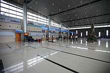
Buon Ma Thuot Airport (IATA: BMV, ICAO: VVBM) (Vietnamese: Sân bay Buôn Ma Thuột) is a public airport in Vietnam. The airport is located in Đắk Lắk Province and has one functional runway. A second incomplete runway (marked with a faded 27 R) is not in use. Two aprons are located on the south side of the airport with buildings that appeared to be used for aircraft storage. A barracks-like camp is located to the north side of the airport. This airport handled 860,000 passenger in 2016.[1]
Airlines and destinations
| Airlines | Destinations |
|---|---|
| Jetstar Pacific Airlines | Da Nang,[2] Hai Phong, Ho Chi Minh City, Thanh Hoa |
| VietJet Air | Hai Phong,[3] Hanoi, Ho Chi Minh City, Vinh[4] |
| Vietnam Airlines | Da Nang, Hanoi, Ho Chi Minh City |
See also
References
- 1 2 "Cảng hàng không Buôn Ma Thuột đảm bảo môi trường luôn "xanh-sạch-đẹp"" (in Vietnamese). ACV. 9 September 2015.
- ↑ "Jetstar Pacific expands Da Nang service in S17". routesonline. Retrieved 27 March 2017.
- ↑ "Vietjet Air Adds New Domestic Routes from May 2016". airlineroute. Retrieved 28 April 2016.
- ↑ http://www.vietjetair.com/UserFiles/file/lichbay/LICH-BAY-NOI-DIA-2017.pdf
This article is issued from
Wikipedia.
The text is licensed under Creative Commons - Attribution - Sharealike.
Additional terms may apply for the media files.