Blythe Township, Schuylkill County, Pennsylvania
| Blythe Township, Pennsylvania | |
|---|---|
| Township | |
 Market Street (U.S. Route 209) in Cumbola. | |
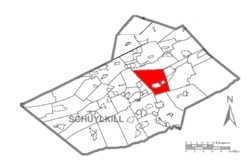 Map of Schuylkill County, Pennsylvania Highlighting Blythe Township | |
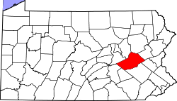 Map of Schuylkill County, Pennsylvania | |
| Country | United States |
| State | Pennsylvania |
| County | Schuylkill |
| Settled | 1805 |
| Incorporated | 1846 |
| Area[1] | |
| • Total | 27.77 sq mi (71.94 km2) |
| • Land | 27.59 sq mi (71.45 km2) |
| • Water | 0.19 sq mi (0.48 km2) |
| Population (2010) | |
| • Total | 924 |
| • Estimate (2016)[2] | 900 |
| • Density | 32.62/sq mi (12.60/km2) |
| Time zone | UTC-5 (Eastern (EST)) |
| • Summer (DST) | UTC-4 (EDT) |
| FIPS code | 42-107-07336 |
Blythe Township is a township in Schuylkill County, Pennsylvania, United States. Formed in 1846 from part of Schuylkill Township, it is named for State Legislator Calvin Blythe.
Geography
According to the United States Census Bureau, the township has a total area of 27.7 square miles (72 km2), of which, 27.5 square miles (71 km2) of it is land and 0.2 square miles (0.52 km2) of it (0.69%) is water.
Demographics
| Historical population | |||
|---|---|---|---|
| Census | Pop. | %± | |
| 2010 | 924 | — | |
| Est. 2016 | 900 | [2] | −2.6% |
| U.S. Decennial Census[3] | |||
As of the census[4] of 2000, there were 905 people, 386 households, and 250 families residing in the township. The population density was 32.9 people per square mile (12.7/km²). There were 421 housing units at an average density of 15.3/sq mi (5.9/km²). The racial makeup of the township was 99.45% White, 0.33% Asian, and 0.22% from two or more races. Hispanic or Latino of any race were 0.33% of the population.
There were 386 households out of which 21.5% had children under the age of 18 living with them, 50.5% were married couples living together, 9.3% had a female householder with no husband present, and 35.0% were non-families. 29.8% of all households were made up of individuals and 14.8% had someone living alone who was 65 years of age or older. The average household size was 2.34 and the average family size was 2.91.
In the township the population was spread out with 18.0% under the age of 18, 7.1% from 18 to 24, 30.8% from 25 to 44, 24.2% from 45 to 64, and 19.9% who were 65 years of age or older. The median age was 41 years. For every 100 females, there were 101.6 males. For every 100 females age 18 and over, there were 94.8 males.
The median income for a household in the township was $34,044, and the median income for a family was $43,672. Males had a median income of $30,972 versus $22,386 for females. The per capita income for the township was $16,348. About 9.3% of families and 10.3% of the population were below the poverty line, including 14.5% of those under age 18 and 10.0% of those age 65 or over.
References
- ↑ "2016 U.S. Gazetteer Files". United States Census Bureau. Retrieved Aug 14, 2017.
- 1 2 "Population and Housing Unit Estimates". Retrieved June 9, 2017.
- ↑ "Census of Population and Housing". Census.gov. Retrieved June 4, 2016.
- ↑ "American FactFinder". United States Census Bureau. Archived from the original on 2013-09-11. Retrieved 2008-01-31.
External links
Coordinates: 40°44′00″N 76°07′59″W / 40.73333°N 76.13306°W