Bleury
| Bleury | |
|---|---|
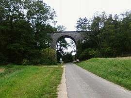 Viaduct | |
 Bleury Location within Centre-Val de Loire region  Bleury | |
| Coordinates: 48°31′14″N 1°44′54″E / 48.5206°N 1.7483°ECoordinates: 48°31′14″N 1°44′54″E / 48.5206°N 1.7483°E | |
| Country | France |
| Region | Centre-Val de Loire |
| Department | Eure-et-Loir |
| Arrondissement | Chartres |
| Canton | Maintenon |
| Intercommunality | Val de Voise |
| Government | |
| • Mayor (2008–2014) | Juliett Guiot |
| Area1 | 7.85 km2 (3.03 sq mi) |
| Population (2008)2 | 488 |
| • Density | 62/km2 (160/sq mi) |
| Time zone | UTC+1 (CET) |
| • Summer (DST) | UTC+2 (CEST) |
| INSEE/Postal code | 28042 /28700 |
| Elevation |
113–156 m (371–512 ft) (avg. 128 m or 420 ft) |
|
1 French Land Register data, which excludes lakes, ponds, glaciers > 1 km2 (0.386 sq mi or 247 acres) and river estuaries. 2 Population without double counting: residents of multiple communes (e.g., students and military personnel) only counted once. | |
Bleury is a former commune in the Eure-et-Loir department in northern France. In January 2012 it merged with Saint-Symphorien-le-Château into the new commune Bleury-Saint-Symphorien.
Population
| Historical population | ||
|---|---|---|
| Year | Pop. | ±% |
| 1962 | 162 | — |
| 1968 | 164 | +1.2% |
| 1975 | 176 | +7.3% |
| 1982 | 270 | +53.4% |
| 1990 | 395 | +46.3% |
| 1999 | 422 | +6.8% |
| 2008 | 488 | +15.6% |
See also
References
| Wikimedia Commons has media related to Bleury (Eure-et-Loir). |
This article is issued from
Wikipedia.
The text is licensed under Creative Commons - Attribution - Sharealike.
Additional terms may apply for the media files.