Blatnica Valley
| Blatnica (Blatnická dolina) | |
| Valley | |
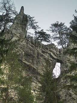 Rock window in the Blatnica Valley | |
| Country | Slovakia |
|---|---|
| Region | Žilina |
| District | Martin |
| Municipality | Blatnica |
| River | Blatnica Stream |
| Location | Juriašovo crossing |
| - coordinates | 48°54′22″N 18°57′47″E / 48.90607°N 18.96319°ECoordinates: 48°54′22″N 18°57′47″E / 48.90607°N 18.96319°E |
| Lowest point | merger with Gader Valley |
| - coordinates | 48°55′55″N 18°56′06″E / 48.93195°N 18.93493°E |
| Length | 8 km (5 mi) |
| Geology | limestone, dolomite |
| Easiest access | dirt road |
  Location of Blatnica in Slovakia | |
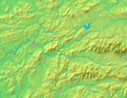  Location of Blatnica Valley in the Žilina Region | |
The Blatnica Valley (Slovak: Blatnická dolina) is a karst valley in the Greater Fatra Range in Slovakia. It is accessible from the village of Blatnica along a dirt road. Most of the valley is densely forested, in places with views at the surrounding lime and dolomite rocks. The best known part of the valley is the rock window at its lower part. Ostrá and Drieňok mountains can be climbed from the valley bottom.
This article is issued from
Wikipedia.
The text is licensed under Creative Commons - Attribution - Sharealike.
Additional terms may apply for the media files.