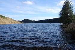
Blackmill Loch
| Blackmill Loch | |
|---|---|
 | |
| Location | Minard, Scotland |
| Coordinates |
56°06′39″N 5°17′57″W / 56.1107°N 5.2991°WCoordinates: 56°06′39″N 5°17′57″W / 56.1107°N 5.2991°W grid reference NR94549588 |
| Type | Reservoir |
| Basin countries | Scotland, United Kingdom |
| Surface area | 130,000 m2 (1,400,000 sq ft) |
| Surface elevation | 139 m (456 ft) |
Blackmill Loch is an impounding reservoir constructed in 1964 and is one source of freshwater for the Lochgair Hydroelectric Scheme. The loch feeds the River Add, when not diverted for hydroelectric purposes. It is one of the two significant forest lochs to the north of Loch Glashan, the other being Loch Bealach Ghearran.
See also
Sources
This article is issued from
Wikipedia.
The text is licensed under Creative Commons - Attribution - Sharealike.
Additional terms may apply for the media files.