Bisagno (stream)
| Bisagno | |
|---|---|
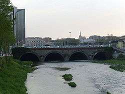 The stream before Genova Brignole | |
| Country | Italy |
| Physical characteristics | |
| Main source | Passo della Scoffera |
| River mouth |
Ligurian Sea in Genoa (Italy) 0 m (0 ft) 44°23′42.47″N 8°56′35.37″E / 44.3951306°N 8.9431583°ECoordinates: 44°23′42.47″N 8°56′35.37″E / 44.3951306°N 8.9431583°E |
| Length | 25 km (16 mi)[1] |
| Discharge |
|
| Basin features | |
| Basin size | 95 km2 (37 sq mi)[1] |
The Bisagno (in Ligurian Besagno /beˈzaɲu/) is a 25-kilometre (16 mi) stream of Liguria (Italy).
Geography
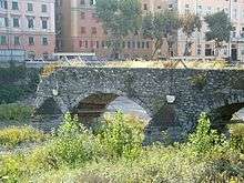
Sant'Agata old bridge
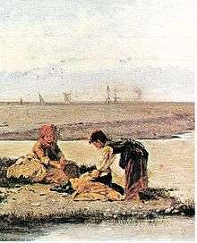
Antonio Varni: Bisagno mouth with laundresses at the end of the 19th century
The river rises near Scoffera pass at around 600 m in the Ligurian Apennines. It flows south-west in the Bisagno Valley and receives its two main tributaries, called torrente Lentro (from the left hand) and torrente Canate (from the right hand). Heading south it reaches Genova and ends its course in the Ligurian Sea. The last part of its course, from Genova Brignole railway station to the mouth, has been transformed in a water tunnel.[1]
Bisagno basin (95 km2) is totally included in the Province of Genova.[3]
Main tributaries
- Left hand:
- torrente Lentro,
- rio Montesignano,
- rio Fereggiano.
- Right hand:
- torrente Canate,
- rio Torbido,
- torrente Geirato
- rio Trensasco,
- rio Cicala,
- rio Veilino.
History
The Département du Bisagne o Dipartimento del Bisagno of Ligurian Republic took its name at the end of the 18th century from the stream.[4]
References
- 1 2 3 Ufficio Pianificazione Territoriale della Città Metropolitana di Genova (2015). PIANO DI BACINO STRALCIO PER LA TUTELA DAL RISCHIO IDROGEOLOGICO (PDF). cartogis.provincia.genova.it (in Italian). Provincia di Genova. Retrieved December 7, 2015.
- ↑ Piano di bacino - Stralcio sul bilancio idrico - IL BACINO DEL TORRENTE BISAGNO, AA.VV., pag.174, Provincia di Genova; on-line version on cartogis.provincia.genova.it Archived February 3, 2016, at the Wayback Machine., accessed in December 2015.
- ↑ 1:25.000 map of the Istituto Geografico Militare, on-line on www.pcn.minambiente.it/viewer
- ↑ Gazzetta universale (in Italian). 1797. Retrieved 2015-12-07.
See also
External links

This article is issued from
Wikipedia.
The text is licensed under Creative Commons - Attribution - Sharealike.
Additional terms may apply for the media files.