Feliceni
| Feliceni Felsőboldogfalva | |
|---|---|
| Commune | |
 | |
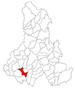 Location of the commune | |
 Feliceni Location of the commune | |
| Coordinates: 46°16′0″N 25°16′0″E / 46.26667°N 25.26667°ECoordinates: 46°16′0″N 25°16′0″E / 46.26667°N 25.26667°E | |
| Country |
|
| County | Harghita County |
| Status | Commune |
| Government | |
| • Mayor | József Sándor (Democratic Union of Hungarians in Romania) |
| Area | |
| • Total | 78.91 km2 (30.47 sq mi) |
| Elevation | 601 m (1,972 ft) |
| Population (2011) | |
| • Total | 3,026[1] |
| • Density | 38.37/km2 (99.4/sq mi) |
| Ethnicity (2002) | |
| • Hungarians | 99.31% |
| • Romanians | 0.69% |
| Time zone | UTC+2 (EET) |
| • Summer (DST) | UTC+3 (EEST) |
| Postal Code | 537297 |
| Area code(s) | +40 266 |
| Website |
www |
Feliceni (Hungarian: Felsőboldogfalva, Hungarian pronunciation: [ˈfɛlʃøːboldoɡfɒlvɒ], meaning "Upper Village of the Blessed", referring to the Virgin Mary) is a commune in Harghita County, Romania, in the vicinity of Odorheiu Secuiesc. It forms part of the Székely Land, an ethno-cultural region in eastern Transylvania.
Component villages
The commune is composed of eleven villages:
| In Romanian | In Hungarian |
|---|---|
| Alexandrița | Sándortelke |
| Arvățeni | Árvátfalva |
| Cireșeni | Sükő |
| Feliceni | Felsőboldogfalva |
| Forțeni | Farcád |
| Hoghia | Hodgya |
| Oțeni | Ocfalva |
| Polonița | Székelylengyelfalva |
| Tăureni | Bikafalva |
| Teleac | Telekfalva |
| Văleni | Patakfalva |
History
The villages of the commune historically belonged to the Székely seat of Udvarhelyszék, then, from 1876 until 1918, to Udvarhely County in the Kingdom of Hungary. After World War I, by the terms of the Treaty of Trianon of 1920, they became part of Romania.
As a result of the Second Vienna Award, the region belonged again to Hungary between 1940 and 1944. After World War II, it came under Romanian administration and became part of Romania in 1947. Between 1952 and 1960, the villages formed part of the Hungarian Autonomous Province, then, of the Mureș-Hungarian Autonomous Province until it was abolished in 1968. Since then, the commune has been part of Harghita County.
Demographics
The commune has an absolute Székely (Hungarian) majority. According to the 2002 census it has a population of 3,026 of which 99.31% or 3,005 are Hungarian[2]
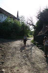
Poloniţa
Polonița (Hungarian: Székelylengyelfalva, or colloquially Lengyelfalva, Hungarian pronunciation: [seːkɛjlɛnɟɛlfɒlvɒ], meaning "Poles' village") is located along the Polonița (Lengyelfalvi) Creek in a narrow valley. It had 319 inhabitants in 2002 (down from 503 in 1910), of whom 315 were Hungarians.
The village was first mentioned in 1505 as Lengenfalwa when a certain Balthasar was elected "seat judge" at Udvarhely. In 1533, the name was recorded as Lengyelfalva. In 1899, the ethnonym Székely was added to the Hungarian placename in order to distinguish the locality from another Lengyelfalva (now: Košická Polianka) of the historical Kingdom of Hungary. The Romanian name derives from the Hungarian one and was originally used as Lenghelfalău which was later Romanianized by translation.[3]
Its Roman Catholic church was built in 1802 replacing the medieval church.
References
- ↑ (in Romanian) harghita.insse.ro - Recensământul populaţiei şi al locuinţelor 2011, judeţul Harghita (date ptrovizorii); retrieved on April 26, 2013
- ↑ Official census 2002
- ↑ János András Vistai. "Tekintő – Erdélyi Helynévkönyv". Missing or empty
|url=(help) Transylvanian Toponym Book 2nd volume at Lengyelfalva
