Beryl Prairie
| Beryl Prairie | |
|---|---|
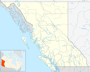
 Beryl Prairie Location of Beryl Prairie in British Columbia | |
| Coordinates: 56°05′00″N 122°02′00″W / 56.08333°N 122.03333°WCoordinates: 56°05′00″N 122°02′00″W / 56.08333°N 122.03333°W | |
| Country |
|
| Province |
|
| Area code(s) | 250, 778 |
Beryl Prairie is a locality in the Peace River Country of British Columbia, Canada, located just northwest of the town of Hudson's Hope, between Portage and Brenot Creeks.[1] It has about 300 people. It has agriculture, logging, and oil. It has its own water stand, and fire hall, with its own volunteer firefighters. It connects to the Farrell Creek Road, about 40 km up.
References
This article is issued from
Wikipedia.
The text is licensed under Creative Commons - Attribution - Sharealike.
Additional terms may apply for the media files.