Bârzava (Timiș)
| Bârzava Brzava (Брзава) Berzava Bersau | |
| River | |
 | |
| Countries | Romania, Serbia |
|---|---|
| Regions | Caraș-Severin, Timiș, Vojvodina |
| Towns | Reșița, Bocșa |
| Source | |
| - location | Semenic Mountains, Romania |
| Mouth | Timiș/Tamiš |
| - location | near Botoš, Serbia |
| - coordinates | 45°17′59″N 20°38′46″E / 45.29972°N 20.64611°ECoordinates: 45°17′59″N 20°38′46″E / 45.29972°N 20.64611°E |
| Length | 166 km (103 mi) |
| Basin | 1,190 km2 (459 sq mi) |
| Progression | Timiș→ Danube→ Black Sea |
The Bârzava or Brzava (Romanian: Bârzava, Serbian: Брзава / Brzava, Hungarian: Berzava, German: Bersau) is a river in Romania and Serbia. The Bârzava is 166 km long, has a drainage area of 1,190 km² (part of the Black Sea drainage basin) and flows into the river Timiș (or Tamiš).
Name
The Romanian forms Bârzava and Bêrzava (last form yet in 19th century newspapers) are of Dacian origin and means "birch river" (cf. Latvian river names Bērzupe and Bārzupe 'birch river', -ava is common ending for Baltic river names, cf. Daugava). The Serbian form Brzava is a derivation from Bêrzava and adopted to Serbian brz/брз 'quick', thus meaning "the quick river" in Slavic languages. Bârzava name had been also given to a commune in Arad, and a village in Harghita.
Romania
The Bârzava springs out in the Semenic Mountains part of the Carpathian Mountains, western Romania, east of the city of Reșița. The river runs to the northeast, close to the Piatra Goznei peak and through the village of Vâliug, reaching the northernmost part of the Semenic mountains, where it turns to the northwest. It runs through the cities of Reșița and Bocșa the largest settlements on its course, and continues next to the villages of Berzovia, and Șoșdea, where the Bârzava leaves the mountain region of Banat for the lower western plain. This is also where the river turns to the southwest, spills in several parallel streams and flows next to the villages of Sculia, Gătaia, Sângeorge, Rovinița Mare and Denta. From this point, until its confluence into the Tamiš, the Bârzava's river bed is channeled. After it flows next to the village of Partoș, it forms the Romanian-Serbian border for a few kilometers and after the course of 127 km through Romania, the Bârzava enters the Serbian province of Vojvodina near the hamlet of Markovićevo.
Serbia
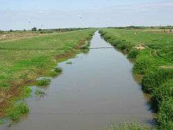
The Brzava runs next to the villages of Konak and Banatska Dubica, where it becomes part of the largest canal system in Serbia, Canal Danube-Tisa-Danube. The only remaining settlement on the river is the village of Jarkovac, before it empties into the Tamiš, south of the village of Botoš. The river's complete 39 km course through Serbia is statistically classified as a Canal Brzava, but it is not navigable.
Tributaries
The following rivers are tributaries to the river Bârzava:
Left: Crivaia Mare, Grindieș, Văliug, Lișcovu Mare, Râul Alb, Secu, Ranchinu, Sodol, Doman, Bârzăvița, Moravița (upper Bârzava), Gârliște, Moscădin, Fizeș, Boruga, Gorova, Ciopa, Moravița
Right: Berzovița, Alibeg, Izvoru Molidului, Pârâul Băilor Mari, Bolnovăț, Gozna, Izvoru Rău, Cireșna, Breazova, Groposu, Pietrosu, Țerova, Vornic, Smida, Stoiconic, Birdanca
Settlements located near the river
In Romania: Văliug, Reșița, Bocșa, Berzovia, Gătaia, Denta
In Serbia: Markovićevo, Konak, Banatska Dubica, Jarkovac
References
- Jovan Đ. Marković (1990): Enciklopedijski geografski leksikon Jugoslavije; Svjetlost-Sarajevo; ISBN 86-01-02651-6
- Atlas svijeta, Fifth edition (1974); Jugoslavenski leksikografski zavod
- Administrația Națională Apelor Române – Cadastrul Apelor – București
- Institutul de Meteorologie și Hidrologie – Rîurile României – București 1971
- Trasee turistice – județul Caraș
- Trasee turistice – județul Timiș