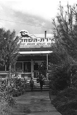
Ayelet HaShahar
| Ayelet HaShahar אַיֶּלֶת הַשַּׁחַר | |
|---|---|
| Hebrew transcription(s) | |
| • official | Ayyelet HaShahar |
 | |
 Ayelet HaShahar | |
| Coordinates: 33°1′22.07″N 35°34′39.35″E / 33.0227972°N 35.5775972°ECoordinates: 33°1′22.07″N 35°34′39.35″E / 33.0227972°N 35.5775972°E | |
| District | Northern |
| Council | Upper Galilee |
| Affiliation | Kibbutz Movement |
| Founded | 1915 |
| Founded by | European Jewish immigrants |
| Population (2017)[1] | 1,161 |
| Website | www.ayelet.org.il |
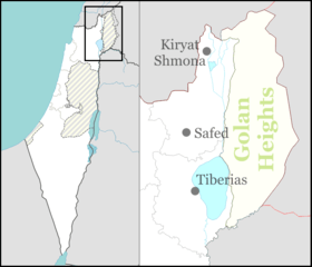
Ayelet HaShahar (Hebrew: אַיֶּלֶת הַשַּׁחַר) is a kibbutz in northern Israel. Located on the Rosh Pina – Metulla road, it is approximately 35 kilometers south of Kiryat Shmona and falls under the jurisdiction of Upper Galilee Regional Council. In 2017 it had a population of 1,161.[1]
History
The land on which the kibbutz is located was bought by the Jewish Colonization Association in 1892. It was first settled by immigrants from Europe in 1915 during the Second Aliyah period. A census conducted in 1922 by the British Mandate authorities, recorded a population of 78 Jews.[2] During the end of the British mandate, the kibbutz was the staging ground for Palmach operations, "Markolet" (Night of the bridges) and the bombing of the Yarmuk Bridge (16–17 June 1946).
After the 1947–1949 Palestine war, Ayelet HaShahar took over land from the newly depopulated Palestinian village of Yarda.[3]
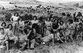 Palmach youth group at Ayelet Hashahar, 1946
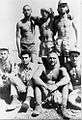 Yiftach 3rd Battalion. Ayelet HaShahar. 1948
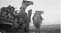 Collecting stray camels. Ayelet HaShahar. 1948
Economy
Ayelet HaShahar is one of the larger fruit producers in Israel. They also raise dairy cattle and poultry, and manage beehives (the kibbutz is a major producer of Israel's honey). There are fish ponds, which take water from canals that drain the nearby Hula Valley swamps.
Landmarks
Tel Hazor, capital of Canaanite Galilee, lies opposite the kibbutz. The Archaeological Museum of Hatzor is located at the kibbutz. Antiquities from Tel Hazor are displayed, but many of the original artifacts are actually at the Israel Museum in Jerusalem.
Notable residents
- Avshalom Okashi, artist[4]
- Tzruya Lahav, songwriter, singer, and novelist
References
- 1 2 "List of localities, in Alphabetical order" (PDF). Israel Central Bureau of Statistics. Retrieved August 26, 2018.
- ↑ Barron, 1923, p. 41
- ↑ Khalidi, W. (1992). All That Remains: The Palestinian Villages Occupied and Depopulated by Israel in 1948. Washington D.C.: Institute for Palestine Studies. p. 504. ISBN 0-88728-224-5.
- ↑ Israel Museum Israeli Art Information Center
Bibliography
- Barron, J. B., ed. (1923). Palestine: Report and General Abstracts of the Census of 1922. Government of Palestine.
External links
- Kibbutz website (in Hebrew)
- What's happening to the kibbutz? article written by Ellis Shuman, June 16, 2004, mentions the vote by members of Kibbutz Ayelet Hashahar to transform their cooperative into a moshav.
- Mevo HaGalil Elementary School