Assamo
| Assamo أسامو Ina ‘Assamo | |
|---|---|
| Town | |
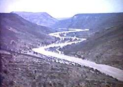 The Assamo Valley in 1967 | |
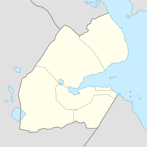 Assamo أسامو Location in Djibouti. | |
| Coordinates: 10°59′00″N 42°50′00″E / 10.98333°N 42.83333°ECoordinates: 10°59′00″N 42°50′00″E / 10.98333°N 42.83333°E | |
| Country |
|
| Region | Ali Sabieh |
| Elevation | 757 m (2,484 ft) |
| Population (2012) | |
| • Total | 500 |
| Time zone | UTC+3 (EAT) |
| Climate | BSh |
Assamo (Arabic: أسامو), also known as Ina ‘Assamo, It is located around 120 kilometers south of the capital, Djibouti City. The surrounding district is rich in both livestock and fledgeling agriculture. Its population, with the nomadic and semi-nomadic neighborhoods is estimated at 500 people.
Overview
During the Middle Ages, Assamo was ruled by the Ifat Sultanate and Adal Sultanate. It later formed a part of the French Somaliland protectorate in the first half of the 20th century. The town has an old fort built on top of a mountain by the French Army. The area also served as an agricultural market for nearby localities.
Assamo lies along a river, near the border with Ethiopia. Nearby towns and villages include Ali Sabieh, Dewele, Guelile and Ali Adde.
Demographics
As of 2012, the population of Assamo has been estimated to be 500. The city inhabitants belong to various mainly Afro-Asiatic-speaking ethnic groups, with the Issa Somali predominant.
Climate
Assamo features a somewhat rare version of a highland climate with warm, but not hot, summers and cool winters. Due to its 754 m altitude, temperatures are relatively mild for a town located not particularly far from deserts. Characterized by hot and dry summers, and mild to cool winters where most of the precipitation is concentrated (spring and autumn being pleasantly warm transitional seasons). However, due to the town's altitude and inland location, its climate features are the humidity is very low, and temperatures usually fall on 27 °C (81 °F) at night, which makes summer particularly pleasant compared to coastal cities.
Assamo has a hot semi-arid climate (BSh) in Köppen-Geiger system.
| Climate data for Assamo | |||||||||||||
|---|---|---|---|---|---|---|---|---|---|---|---|---|---|
| Month | Jan | Feb | Mar | Apr | May | Jun | Jul | Aug | Sep | Oct | Nov | Dec | Year |
| Average high °C (°F) | 26.1 (79) |
27.5 (81.5) |
28.7 (83.7) |
30.9 (87.6) |
33.7 (92.7) |
37.3 (99.1) |
36.9 (98.4) |
35.6 (96.1) |
34.3 (93.7) |
31.0 (87.8) |
28.4 (83.1) |
27.2 (81) |
31.5 (88.6) |
| Average low °C (°F) | 15.7 (60.3) |
17.5 (63.5) |
19.2 (66.6) |
21.6 (70.9) |
23.8 (74.8) |
26.5 (79.7) |
25.0 (77) |
24.5 (76.1) |
25.0 (77) |
20.7 (69.3) |
18.1 (64.6) |
16.2 (61.2) |
21.2 (70.1) |
| Average precipitation mm (inches) | 14 (0.55) |
11 (0.43) |
21 (0.83) |
30 (1.18) |
13 (0.51) |
6 (0.24) |
25 (0.98) |
45 (1.77) |
30 (1.18) |
9 (0.35) |
13 (0.51) |
5 (0.2) |
222 (8.73) |
| Source: The Weather Channel | |||||||||||||
Agriculture
Assamo is noted for its agricultural and farming industry. Crops grown in the area include vegetables and fruits. Significant investments have been made in the industry.