Asenby
| Asenby | |
|---|---|
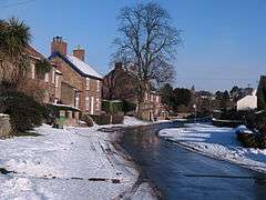 Main Street, Asenby | |
 Asenby Asenby shown within North Yorkshire | |
| Population | 311 |
| OS grid reference | SE396752 |
| District | |
| Shire county | |
| Region | |
| Country | England |
| Sovereign state | United Kingdom |
| Post town | THIRSK |
| Postcode district | YO7 3 |
| Police | North Yorkshire |
| Fire | North Yorkshire |
| Ambulance | Yorkshire |
| EU Parliament | Yorkshire and the Humber |
| UK Parliament | |
Asenby is a village and civil parish in the Harrogate district of North Yorkshire, England, with a population of 285 (2001 census), increasing to 311 at the 2011 census. The village is about 5 miles (8.0 km) south-west of Thirsk and 7 miles (11 km) east of Ripon. It is 12 miles (19 km) south of the County Town of Northallerton on the south bank of the River Swale.
History
The village is mentioned in the Domesday Book as Estanebi in the Yarlestre hundred. It was part of the manor of Topcliffe at the time of the Norman invasion and followed the descent of that manor thereafter.[1][2][3]
The topynomy of the village name is the combination of the Norse personal name of Eystein and bi giving the meaning of Eystein's farm.[4][5]
Governance
The village lies within the Skipton and Ripon UK Parliament constituency. It is also within the Wathvale war of Harrogate Borough District Council and the Mashams and Fountains electoral division of North Yorkshire County Council.[6] The local Parish Council has five members.[7]
Geography
The village lies on the south bank of the River Swale and wedged in between the A168 and A167 roads. The majority of the surrounding land in the parish is given to farming.[6]
Culture and community
The village is mostly housing with one public house on the outskirts. There is no church in the parish.[8]
Demography
Population[9][10][11]
| Year | 1881 | 1891 | 1901 | 1911 | 1921 | 1931 | 1951 | 1961 | 2001 | 2011 |
|---|---|---|---|---|---|---|---|---|---|---|
| Total | 171 | 177 | 173 | 168 | 161 | 179 | 151 | 161 | 285 | 311 |
2001 Census
Of the total population, 97.5% declared themselves as White/British with the rest being White/Other. The gender split was 50.8% male to 49.2% female. The declaration of religious belief was 77.9% Christian, 20.7% No religion/Not stated and 1% Jewish and 1% Other. There were 128 dwellings.[10]
2011 Census
Of the total population, 97.1% declared themselves as White/British with 1.6% being White/Other. The rest were made of 0.6% mixed White/Asian, 0.3% White/Irish and 0.1% British Asian. The gender split was 51.4% male to 48.6% female. The declaration of religious belief was 72.7% Christian, 25.7% No religion/Not stated and 1.6% Buddhist. There were 130 dwellings.[11]
Notable people
- Mary Bateman (also known as the Yorkshire Witch) was born in the village.[12]
References
- ↑ Asenby in the Domesday Book. Retrieved 8 March 2013.
- ↑ "History". Retrieved 8 March 2013.
- ↑ Bulmer's Topography, History and Directory (Private and Commercial) of North Yorkshire 1890. S&N Publishing. 1890. p. 839. ISBN 1-86150-299-0.
- ↑ Watts (2011). Cambridge Dictionary of English Place-names. Cambridge University Press. p. 19. ISBN 978-0521168557.
- ↑ A.D. Mills (1998). Dictionary of English Place-Names. Oxford Paperbacks. p. 19. ISBN 978-0192800749.
- 1 2 Ordnance Survey Open Viewer
- ↑ "Parish Council". Harrogate Borough Council. 2013. Retrieved 8 March 2013.
- ↑ "Local info". Asenby Net. 2013. Archived from the original on 29 April 2006. Retrieved 8 March 2013.
- ↑ "Population at Cenuses". Vision of Britain. 2009. Retrieved 8 March 2013.
- 1 2 "2001 UK Census". Office for National Statistics. 2002. Retrieved 8 March 2013.
- 1 2 UK Census (2011). "Local Area Report – Asenby Parish (1170216971)". Nomis. Office for National Statistics. Retrieved 4 March 2018.
- ↑ Davies, Owen (2004), "Bateman , Mary (1768–1809)", Oxford Dictionary of National Biography, Oxford University Press, retrieved 9 May 2010
External links
