Aruna Asaf Ali Marg
| Asif Ali Marg | |
|---|---|
| Road | |
 Asif Ali Marg Location in Delhi, India | |
| Coordinates: 28°31′39″N 77°10′11″E / 28.52750°N 77.16972°ECoordinates: 28°31′39″N 77°10′11″E / 28.52750°N 77.16972°E | |
| Country |
|
| State | Delhi |
| Government | |
| • Body | South Delhi Municipal Corporation |
| Languages | |
| • Official | Hindi, English |
| Time zone | UTC+5:30 (IST) |
| Nearest city | Gurgaon |
| Lok Sabha constituency | South West Delhi |
| Civic agency | South Delhi Municipal Corporation |
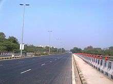
Aruna Asaf Ali Marg from Neela Hauz, Delhi
Aruna Asaf Ali Marg is a road in New Delhi, India that connects Vasant Kunj(Sector-B), Kishangarh Village, Jawaharlal Nehru University, Sanjay Van, Qutab Institutional Area, IIT Delhi, Ber Sarai to the Outer Ring Road or Gamal Abdel Nasser Marg (near Hauz Khas).
The total length is 5 kilometres (3.1 mi). The road is named after the Indian Independence Activist and Teachers Aruna Asaf Ali. The road starts from the Traffic Light of Ranjan Dhall Memorial Fortis Healthcare Hospital, Vasant Kunj and ends at Outer Ring Road.
This article is issued from
Wikipedia.
The text is licensed under Creative Commons - Attribution - Sharealike.
Additional terms may apply for the media files.