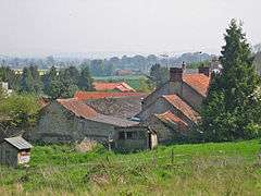
Appleton-le-Street
| Appleton-le-Street | |
|---|---|
 Appleton-le-Street | |
 Appleton-le-Street Appleton-le-Street shown within North Yorkshire | |
| Population | 117 |
| OS grid reference | SE737736 |
| • London | 185 mi (298 km) S |
| District | |
| Shire county | |
| Region | |
| Country | England |
| Sovereign state | United Kingdom |
| Post town | MALTON |
| Postcode district | YO17 |
| Dialling code | 01653 |
| Police | North Yorkshire |
| Fire | North Yorkshire |
| Ambulance | Yorkshire |
| EU Parliament | Yorkshire and the Humber |
| UK Parliament | |
Appleton-le-Street is a small village and in the Ryedale district of North Yorkshire, England. It is approximately 3 miles (5 km) west of Malton and in the parish of Appleton-le-Street with Easthorpe.
History
The village is mentioned in the Domesday Book as "Appletun", part of the Maneshou Hundred. At the time of the Norman Conquest it belonged to Cnut, son of Karli, but subsequently handed over to William I.[1]
The Thirsk & Malton Railway used to pass through the village.[2]
Governance
The village lies within the Thirsk and Malton parliamentary constituency. It also lies within the Amotherby ward of Ryedale District Council and the Malton electoral district of North Yorkshire County Council.
Geography
The civil parish includes the village and the small hamlet of Easthorpe, which lies just over 1 mile (1.6 km) to the south. It is on the B1257 Malton to Stokesley road between Amotherby and Barton-le-Street. It is 1.7 miles (2.7 km) south of the River Rye.[3]
The soil is a mixture of Oxford clay on corallian beds. Limestone and Sandstone were quarried in the village.[4]
Demography
According to the 2001 UK Census, the population for the civil parish was 117 in 53 households. Of those households, 29 were detached dwellings and 34 were owner occupied. Of the total population, 93 were over the age of 16, of which 55 were economically active.[5]
The 2011 census recorded the population as 122.[6]
Religion
The church in the village dates from Saxon times and is a Grade I listed building dedicated as All Saints.[7][8]
References
- ↑ "Domesday Entry". Retrieved 21 October 2012.
- ↑ Bulmer's Topography, History and Directory (Private and Commercial) of North Yorkshire 1890. S&N Publishing. 1890. p. 643. ISBN 1-86150-299-0.
- ↑ "Archived copy". Archived from the original on 5 October 2012. Retrieved 2012-10-14.
- ↑ "Geology". Retrieved 21 October 2012.
- ↑ "Demographics". Retrieved 21 October 2012.
- ↑ UK Census (2011). "Local Area Report – Appleton-le-Street with Easthorpe Parish (1170217212)". Nomis. Office for National Statistics. Retrieved 4 March 2018.
- ↑ "All Saints Church". Retrieved 21 October 2012.
- ↑ Historic England. "Church of All Saints (Grade I) (1296551)". National Heritage List for England. Retrieved 2 February 2017.
External links

- Appleton [le Street] in the Domesday Book