Anixi
| Anoixi Άνοιξη | |
|---|---|
 Anoixi Location within the regional unit 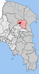 | |
| Coordinates: 38°8′N 23°52′E / 38.133°N 23.867°ECoordinates: 38°8′N 23°52′E / 38.133°N 23.867°E | |
| Country | Greece |
| Administrative region | Attica |
| Regional unit | East Attica |
| Municipality | Dionysos |
| • Municipal unit | 4.582 km2 (1.769 sq mi) |
| Elevation | 370 m (1,210 ft) |
| Population (2011)[1] | |
| • Municipal unit | 6,510 |
| • Municipal unit density | 1,400/km2 (3,700/sq mi) |
| Time zone | UTC+2 (EET) |
| • Summer (DST) | UTC+3 (EEST) |
| Postal code | 145 xx |
| Area code(s) | 210 |
| Vehicle registration | Z |
Anoixi (Greek: Άνοιξη, meaning "spring") is a suburban town in East Attica, Greece. Since the 2011 local government reform it is part of the municipality Dionysos, of which it is a municipal unit.[2] The municipal unit has an area of 4.582 km2.[3]
Geography
Anoixi is situated in the hills in the northeastern part of the Athens conurbation, at about 370 m elevation. It lies east of the Parnitha mountains and northwest of the Penteliko Mountain. It is 1 km south of Agios Stefanos, 9 km west of Marathon and 20 km northeast of Athens city centre. Its built-up area is continuous with those of the neighbouring suburbs Agios Stefanos, Drosia and Stamata.
Motorway 1 (Athens - Lamia - Thessaloniki) and the railway from Athens to Thessaloniki pass west of the town. Greek National Road 83 (Athens - Marathon - Rafina) passes through Anoixi.
Historical population
| Year | Population |
|---|---|
| 1981 | 1,377 |
| 1991 | 2,864 |
| 2001 | 5,397 |
| 2011 | 6,510 |
See also
References
- ↑ "Απογραφή Πληθυσμού - Κατοικιών 2011. ΜΟΝΙΜΟΣ Πληθυσμός" (in Greek). Hellenic Statistical Authority.
- ↑ Kallikratis law Greece Ministry of Interior (in Greek)
- ↑ "Population & housing census 2001 (incl. area and average elevation)" (PDF) (in Greek). National Statistical Service of Greece. Archived from the original (PDF) on 2015-09-21.
Places adjacent to Anixi | ||||||||||
|---|---|---|---|---|---|---|---|---|---|---|
| ||||||||||