Anefif
| Anefif | |
|---|---|
| Commune and village | |
 Anefif Location in Mali | |
| Coordinates: 18°2′40″N 0°36′10″E / 18.04444°N 0.60278°ECoordinates: 18°2′40″N 0°36′10″E / 18.04444°N 0.60278°E | |
| Country |
|
| Region | Kidal Region |
| Cercle | Kidal Cercle |
| Area[1] | |
| • Total | 2,800 km2 (1,100 sq mi) |
| Population (2009)[2] | |
| • Total | 5,087 |
| • Density | 1.8/km2 (4.7/sq mi) |
| Time zone | UTC+0 (GMT) |
Anefif or Anéfis is a Saharan village and commune in the Cercle of Kidal in the Kidal Region of north-eastern Mali. The village lies 95 km (59 mi) southwest of Kidal on the route linking Kidal to Bourem and Gao. In 2009 the commune had a population of 5,087.[2]
The commune has a Saharian climate and is too dry for rain-fed agriculture. The annual rainfall of around 150 mm occurs between late June and early September.[1] Most of the population are nomadic pastoralists.
A battle took place near Anefif 29–30 March 2013 as part of the Northern Mali conflict. It resulted in fighters for the MNLA claiming the village from the Islamist group MOJWA and killing one of the latter's commanders.
References
- 1 2 Programme de renforcement des capacités nationales pour une gestion stratégique du développement (PRECAGED): Schéma d'aménagement et de développement de la Commune Rurale Anefif (in French), République du Mali: Ministère de l'économie programme des nations unies et des finances, 2004, archived from the original on 2012-03-17 .
- 1 2 Resultats Provisoires RGPH 2009 (Région de Kidal) (PDF), République de Mali: Institut National de la Statistique, archived from the original (PDF) on 2011-07-22 .
External links
- Plan de Sécurité Alimentaire Commune Rurale de Anefif 2007-2011 (PDF) (in French), Commissariat à la Sécurité Alimentaire, République du Mali, USAID-Mali, 2007 .
Capital: Kidal | ||
| Abeibara Cercle | 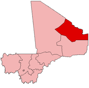 | |
| Kidal Cercle | ||
| Tessalit Cercle |
| |
| Tin-Essako Cercle | ||
This article is issued from
Wikipedia.
The text is licensed under Creative Commons - Attribution - Sharealike.
Additional terms may apply for the media files.