Wat Sing District
| Wat Sing วัดสิงห์ | |
|---|---|
| Amphoe | |
 Wat Pak Khlong Makham Thao in tambon Makham Thao | |
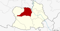 Amphoe location in Chainat Province | |
| Coordinates: 15°15′19″N 100°2′17″E / 15.25528°N 100.03806°ECoordinates: 15°15′19″N 100°2′17″E / 15.25528°N 100.03806°E | |
| Country |
|
| Province | Chainat |
| Seat | Makham Thao |
| Area | |
| • Total | 315.318 km2 (121.745 sq mi) |
| Population (2008) | |
| • Total | 2,632,789 |
| • Density | 83.5/km2 (216/sq mi) |
| Time zone | UTC+7 (THA) |
| Postal code | 17120 |
| Geocode | 1803 |
Wat Sing (Thai: วัดสิงห์, pronounced [wát sǐŋ]) is a district (amphoe) in the northern part of Chainat Province, central Thailand.
Geography
Neighboring districts are (from the northeast clockwise) Manorom, Mueang Chainat, Hankha and Nong Mamong of Chainat Province, Nong Khayang and Mueang Uthai Thani of Uthai Thani Province.
Administration
The district is subdivided into 7 subdistricts (tambon), which are further subdivided into 47 villages (muban). Wat Sing is a subdistrict municipality (thesaban tambon) which covers the whole tambon Wat Sing. There are further 6 Tambon administrative organizations (TAO).
| No. | Name | Thai | Villages | Inh.[1] |
|---|---|---|---|---|
| 1. | Wat Sing | วัดสิงห์ | - | 4,028 |
| 2. | Makham Thao | มะขามเฒ่า | 11 | 5,174 |
| 3. | Nong Noi | หนองน้อย | 8 | 3,744 |
| 4. | Nong Bua | หนองบัว | 5 | 2,755 |
| 6. | Nong Khun | หนองขุ่น | 8 | 3,443 |
| 7. | Bo Rae | บ่อแร่ | 7 | 2,886 |
| 11. | Wang Man | วังหมัน | 8 | 4,359 |
Missing numbers are tambon which now form Nong Mamong district.
References
- ↑ "Population statistics 2008". Department of Provincial Administration.
External links
- amphoe.com (Thai)
This article is issued from
Wikipedia.
The text is licensed under Creative Commons - Attribution - Sharealike.
Additional terms may apply for the media files.