Phang Khon District
| Phang Khon พังโคน | |
|---|---|
| Amphoe | |
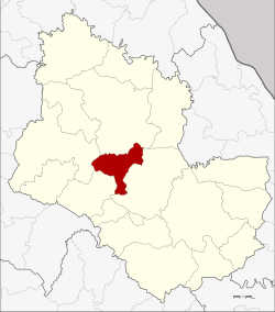 Amphoe location in Sakon Nakhon Province | |
| Coordinates: 17°23′33″N 103°42′34″E / 17.39250°N 103.70944°ECoordinates: 17°23′33″N 103°42′34″E / 17.39250°N 103.70944°E | |
| Country | Thailand |
| Province | Sakon Nakhon |
| Seat | Phang Khon |
| Area | |
| • Total | 383.8 km2 (148.2 sq mi) |
| Population (2005) | |
| • Total | 52,031 |
| • Density | 135.6/km2 (351/sq mi) |
| Time zone | UTC+7 (ICT) |
| Postal code | 47160 |
| Geocode | 4705 |
Phang Khon (Thai: พังโคน, pronounced [pʰāŋ kʰōːn]) is a district (amphoe) of Sakon Nakhon Province, Thailand.
Geography
Neighboring districts are (from the north clockwise) Wanon Niwat, Phanna Nikhom, Waritchaphum and Sawang Daen Din.
The Nam Un dam is in the district.
History
The minor district (king amphoe) was created on 20 March 1968, when the three tambon Muang Khai, Hai Yong, and Rae were split off from Phanna Nikhom District.[1] It was upgraded to a full district on 16 November 1971.[2]
Administration
The district is divided into five sub-districts (tambon), which are further subdivided into 70 villages (muban). Phang Khon is a township (thesaban tambon) which covers parts of tambon Phang Khon. There are a further five tambon administrative organizations (TAO).
| No. | Name | Thai name | Villages | Pop. | |
|---|---|---|---|---|---|
| 1. | Phang Khon | พังโคน | 13 | 13,621 | |
| 2. | Muang Khai | ม่วงไข่ | 11 | 9,366 | |
| 3. | Rae | แร่ | 14 | 8,192 | |
| 4. | Hai Yong | ไฮหย่อง | 18 | 12,700 | |
| 5. | Ton Phueng | ต้นผึ้ง | 14 | 8,152 |
References
- ↑ ประกาศกระทรวงมหาดไทย เรื่อง แบ่งท้องที่ตั้งเป็นกิ่งอำเภอ (PDF). Royal Gazette (in Thai). 85 (25 ง): 835. March 19, 1968.
- ↑ พระราชกฤษฎีกาตั้งอำเภอปลาปาก อำเภอเชียงกลาง อำเภอปากชม อำเภอบ้านม่วง อำเภอพังโคน อำเภอดอนสัก อำเภอพนม อำเภอเวียงสระ อำเภอสังคม และอำเภอหัวตะพาน พ.ศ. ๒๕๑๔ (PDF). Royal Gazette (in Thai). 88 (123 ก): 745–748. November 16, 1971.
External links
This article is issued from
Wikipedia.
The text is licensed under Creative Commons - Attribution - Sharealike.
Additional terms may apply for the media files.