Na Klang District
| Na Klang นากลาง | |
|---|---|
| Amphoe | |
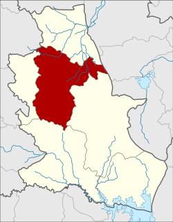 Amphoe location in Nong Bua Lamphu Province | |
| Coordinates: 17°18′26″N 102°11′19″E / 17.30722°N 102.18861°ECoordinates: 17°18′26″N 102°11′19″E / 17.30722°N 102.18861°E | |
| Country | Thailand |
| Province | Nongbua Lamphu |
| Seat | Fang Daeng |
| Area | |
| • Total | 570.656 km2 (220.332 sq mi) |
| Population (2005) | |
| • Total | 90,996 |
| • Density | 159.4/km2 (413/sq mi) |
| Time zone | UTC+7 (ICT) |
| Postal code | 39170 |
| Geocode | 3902 |
Na Klang (Thai: นากลาง; IPA: [nāː klāːŋ]) is a district (amphoe) of Nong Bua Lamphu Province, northeastern Thailand.
History
The district was created as a minor district (king amphoe) on 16 July 1965, when the three tambon Na Klang, Kao Kloi, and Na Si were split from Nong Bua Lam Phu District.[1] It was upgraded to a full district in 1969.[2]
Geography
Neighboring districts are (from the north clockwise) Suwannakhuha of Nong Bua Lamphu Province, Kut Chap of Udon Thani Province, Mueang Nongbua Lamphu, Si Bun Rueang, and Na Wang of Nong Bua Lamphu, and Na Duang of Loei Province.
Administration
The district is divided into nine sub-districts (tambon), which are further subdivided into 119 villages (muban). There are two townships (thesaban tambon) within the district. Na Klang covers parts of the tambon Na Klang, Dan Chang, and Kut Hae, and Kut Din Chi covers parts of the tambon Kut Din Chi. There are a further eight tambon administrative organizations (TAO).
| No. | Name | Thai name | Villages | Pop. | |
|---|---|---|---|---|---|
| 1. | Na Klang | นากลาง | 12 | 12,259 | |
| 2. | Dan Chang | ด่านช้าง | 12 | 10,334 | |
| 5. | Kut Din Chi | กุดดินจี่ | 20 | 16,336 | |
| 6. | Fang Daeng | ฝั่งแดง | 18 | 11,856 | |
| 7. | Kao Kloi | เก่ากลอย | 13 | 8,991 | |
| 9. | Non Mueang | โนนเมือง | 15 | 10,714 | |
| 10. | Uthai Sawan | อุทัยสวรรค์ | 12 | 6,357 | |
| 11. | Dong Sawan | ดงสวรรค์ | 9 | 6,647 | |
| 13. | Kut Hae | กุดแห่ | 8 | 7,502 |
Missing numbers are tambon which are now part of the districts Suwannakhuha and Na Wang
References
- ↑ ประกาศกระทรวงมหาดไทย เรื่อง แบ่งท้องที่ตั้งเป็นกิ่งอำเภอ (PDF). Royal Gazette (in Thai). 82 (57 ง): 1878. July 20, 1965.
- ↑ พระราชกฤษฎีกาจัดตั้งอำเภอสมเด็จ อำเภอสีชมพู อำเภอหนองบัวแดง อำเภอบ้านแท่น อำเภอดอนตูม อำเภอนากลาง อำเภอศรีบุญเรือง และอำเภอป่าติ้ว พ.ศ. ๒๕๑๒ (PDF). Royal Gazette (in Thai). 86 (16 ก): 225–229. February 25, 1969.
External links