Dok Khamtai District
| Dok Khamtai ดอกคำใต้ | |
|---|---|
| Amphoe | |
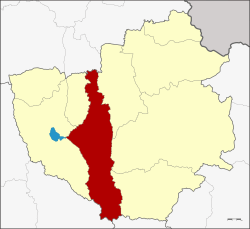 Amphoe location in Phayao Province | |
| Coordinates: 19°9′45″N 99°59′36″E / 19.16250°N 99.99333°ECoordinates: 19°9′45″N 99°59′36″E / 19.16250°N 99.99333°E | |
| Country | Thailand |
| Province | Phayao |
| Seat | Don Si Chum |
| Area | |
| • Total | 823.3 km2 (317.9 sq mi) |
| Population (2005) | |
| • Total | 73,205 |
| • Density | 88.9/km2 (230/sq mi) |
| Time zone | UTC+7 (ICT) |
| Postal code | 56120 |
| Geocode | 5605 |
Dok Khamtai (Thai: ดอกคำใต้, pronounced [dɔ̀ːk kʰām.tâːj]) is a district (amphoe) of Phayao Province in northern Thailand.
History
Originally created in 1832, the district was abolished on 23 December 1917 and incorporated into Phayao District.[1] It was recreated as a minor district (king amphoe) on 23 January 1963.[2] It was again upgraded to a full district on 27 July 1965.[3]
Etymology
Dok Khamtai is the Thai name of the sponge tree (Acacia farnesiana (L.) Willd.).
Geography
Neighboring districts are (from the north clockwise) Pa Daet of Chiang Rai Province, Chun, Pong and Chiang Muan of Phayao Province, Song of Phrae Province, Ngao of Lampang Province, and Mueang Phayao and Phu Kamyao of Phayao again.
The main water course is the Ing River. Doi Phu Nang National Park is in the district.
Economy
The district is "...famous in Thailand for the numbers of sex workers it exports and there is even a popular song titled "plaeng saaw dok kham tai" (song of the young women from Dok Kham Tai) about girls from this district coming to Bangkok." The district is also mentioned prominently in Pasuk Phongpaichit's 1982 study, From Peasant Girls to Bangkok Masseuses.[4]:60
Administration
The district is divided into 12 sub-districts (tambon), which are further subdivided into 124 villages (muban). There are two townships (thesaban tambon). Dok Khamtai covers parts of tambon Dok Khamtai, Don Si Chum, Sawang Arom, and the whole tambon Bun Koet. Ban Tham covers the whole tambon Ban Tham. There are further nine tambon administrative organizations (TAO).
| No. | Name | Thai name | Pop. | ||
|---|---|---|---|---|---|
| 1. | Dok Khamtai | ดอกคำใต้ | 6,274 | ||
| 2. | Don Si Chum | ดอนศรีชุม | 6,222 | ||
| 3. | Ban Tham | บ้านถ้ำ | 8,510 | ||
| 4. | Ban Pin | บ้านปิน | 5,526 | ||
| 5. | Huai Lan | ห้วยลาน | 9,326 | ||
| 6. | San Khong | สันโค้ง | 6,594 | ||
| 7. | Pa Sang | ป่าซาง | 5,379 | ||
| 8. | Nong Lom | หนองหล่ม | 5,968 | ||
| 9. | Dong Suwan | ดงสุวรรณ | 5,338 | ||
| 10. | Bun Koet | บุญเกิด | 5,037 | ||
| 11. | Sawang Arom | สว่างอารมณ์ | 4,243 | ||
| 12. | Khue Wiang | คือเวียง | 4,788 |
References
- ↑ ประกาศกระทรวงมหาดไทย เรื่อง ให้ยุบอำเภอแม่ใจและอำเภอดอกคำใต้ (PDF). Royal Gazette (in Thai). 34 (0 ก): 505. December 23, 1917.
- ↑ ประกาศกระทรวงมหาดไทย เรื่อง แบ่งท้องที่ตั้งเป็นกิ่งอำเภอ (PDF). Royal Gazette (in Thai). 80 (14 ง): 221–222. February 5, 1963.
- ↑ พระราชกฤษฎีกาตั้งอำเภอศรีสวัสดิ์ อำเภอสังขละบุรี อำเภอท่าคันโท อำเภอดอกคำใต้ อำเภอแม่ใจ อำเภอจุน อำเภอขามทะเลสอ อำเภอไพศาลี อำเภอท่าวังผา อำเภอบ้านกรวด อำเภอเด่นชัย อำเภอปทุมรัตต์ อำเภอกะเปอร์ อำเภออากาศอำนวย อำเภอดอนเจดีย์ อำเภอจอมพระ และอำเภอสามโก้ พ.ศ. ๒๕๐๘ (PDF). Royal Gazette (in Thai). 81 (49 ก): 565–569. July 27, 1965.
- ↑ Boonchalaksi, Wathinee; Guest, Philip (1994). Prostitution in Thailand (PDF). Institute for Population and Social Research, Mahidol University. ISBN 9745876569. Retrieved 13 January 2018.