Charoen Sin District
| Charoen Sin เจริญศิลป์ | |
|---|---|
| Amphoe | |
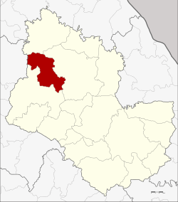 Amphoe location in Sakon Nakhon Province | |
| Coordinates: 17°35′48″N 103°33′56″E / 17.59667°N 103.56556°ECoordinates: 17°35′48″N 103°33′56″E / 17.59667°N 103.56556°E | |
| Country | Thailand |
| Province | Sakon Nakhon |
| Seat | Charoen Sin |
| Area | |
| • Total | 401.0 km2 (154.8 sq mi) |
| Population (2005) | |
| • Total | 42,375 |
| • Density | 105.7/km2 (274/sq mi) |
| Time zone | UTC+7 (ICT) |
| Postal code | 47290 |
| Geocode | 4716 |
Charoen Sin (Thai: เจริญศิลป์, pronounced [t͡ɕʰā.rɤ̄ːn sǐn]) is a district (amphoe) of Sakon Nakhon Province, northeast Thailand.
Geography
Neighboring districts are (from the north clockwise) Ban Muang, Wanon Niwat and Sawang Daen Din of Sakon Nakhon Province, and Ban Dung of Udon Thani Province.
History
The minor district (king amphoe) Charoen Sin was established on 15 February 1988, when five tambons were split off from Sawang Daen Din District.[1] It was upgraded to a full district on 4 July 1994.[2]
Administration
The district is divided into five sub-districts (tambon), which are further subdivided into 52 villages (muban). The sub-district municipality (thesaban tambon) Charoen Sin covers parts of the tambon Charoen Sin and Thung Kae. There are a further five tambon administrative organizations (TAO).
| No. | Name | Thai name | Villages | Pop. | |
|---|---|---|---|---|---|
| 1. | Ban Lao | บ้านเหล่า | 13 | 11,571 | |
| 2. | Charoen Sin | เจริญศิลป์ | 11 | 10,682 | |
| 3. | Thung Kae | ทุ่งแก | 9 | 6,928 | |
| 4. | Khok Sila | โคกศิลา | 8 | 4,830 | |
| 5. | Nong Paen | หนองแปน | 11 | 8,364 |
References
- ↑ ประกาศกระทรวงมหาดไทย เรื่อง แบ่งเขตท้องที่อำเภอสว่างแดนดิน จังหวัดสกลนคร ตั้งเป็นกิ่งอำเภอเจริญศิลป์ (PDF). Royal Gazette (in Thai). 105 (21 ง special): 71. February 5, 1988.
- ↑ พระราชกฤษฎีกาตั้งอำเภอเปือยน้อย ... และอำเภอศรีวิไล พ.ศ. ๒๕๓๗ (PDF). Royal Gazette (in Thai). 111 (21 ก): 32–35. June 3, 1994.
External links