Alma River (Crimea)
| Alma | |
|---|---|
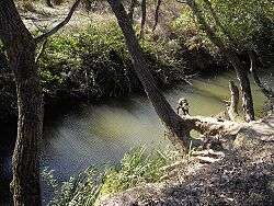 Alma river near memorial of Battle of Alma | |
| Native name | Альма |
| Country | Crimea |
| Physical characteristics | |
| Main source | Babuğan Yayla, Crimean Mountains |
| River mouth | Kalamita bay of the Black Sea |
| Length | 83 km (52 mi) |
The Alma (Ukrainian: Альма; Russian: Альма, Crimean Tatar: Alma) is a small river in Crimea that flows into the Black Sea. Its mouth is halfway between Yevpatoria and Sevastopol. Alma is the Crimean Tatar word for an "apple".
History
The Alma is formed by the confluence of the Sary-su, the Savlykh-su and the Babuganka (Babuğan Yayla) rivers, and flows mostly through the mountains.[1] The Alminskoye and Partizanskoye storage reservoirs are located along its course.[1]
Near the Alma river the allied British, French, and Ottoman armies defeated the Russians under Prince Aleksandr Sergeevich Menshikov on 20 September 1854.[2]
References
External links
| Wikimedia Commons has media related to Alma River. |
Coordinates: 44°50′45″N 33°35′38″E / 44.84583°N 33.59389°E
This article is issued from
Wikipedia.
The text is licensed under Creative Commons - Attribution - Sharealike.
Additional terms may apply for the media files.